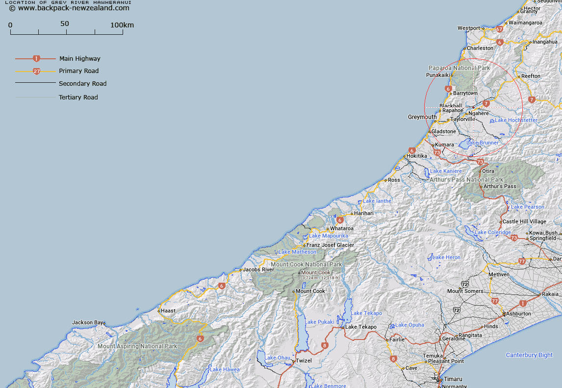
Map showing location of Grey River/Māwheranui


LINZ description: Feature shown on: NZMS260-J31 613613; NZTopo50-BT20 770104;
Latitude: -42.348584
Longitude: 171.50773
Northing: 5310441.3
Easting: 1477089.2
Land District: Westland
Feat Type: Stream


Scroll down to see a more detailed road map and below that a topographical map showing the location of Grey River/Māwheranui. The road map has been supplied by openstreetmap and the topographical map of Grey River/Māwheranui has been supplied by Land Information New Zealand (LINZ).

Yes you can use the top static map for you school/university project or personal website with a link back. Contact me for any commercial use.
Grey River/Māwheranui Map New Zealand


New Zealand places in our database
[ A ] [ B ] [ C ] [ D ] [ E ] [ F ] [ G ] [ H ] [ I ] [ J ] [ K ] [ L ] [ M ] [ N ] [ O ] [ P ] [ Q ] [ R ] [ S ] [ T ] [ U ] [ V ] [ W ] [ X ] [ Y ] [ Z ]


Closest 20 Streams to Grey River/Māwheranui

Mirfins Creek ( 2.73km )   O'Rourkes Creek ( 3.21km )   Baxter Creek ( 3.3km )   Sullivan Creek ( 5.14km )   Caledonian Creek ( 5.16km )   Callaghans Creek ( 5.36km )   Granity Creek ( 5.41km )   Scotchman Creek ( 5.61km )   Nelson Creek ( 5.71km )   Lafferty Creek ( 5.95km )   Claughesys Creek ( 6km )   Ahaura River ( 6.01km )   Prices Creek ( 6.24km )   Youngs Creek ( 6.38km )   Cockabulla Creek ( 6.41km )   Moonlight Creek ( 6.96km )   Henry Creek ( 7.17km )   Potts Creek ( 7.18km )   Wishart Creek ( 7.47km )   Kaka Creek ( 7.48km )   Fitzgerald Creek ( 7.52km )   Orwell Creek ( 7.54km )   Turner Creek ( 7.6km )   Roaring Meg Creek ( 7.95km )   Red Jacks Creek ( 8.12km )   Gows Creek ( 8.16km )   Surprise Creek ( 8.34km )   Kangaroo Creek ( 8.38km )   Garden Creek ( 8.44km )   McCarthy Creek ( 8.56km )   Hatters Creek ( 8.68km )   Hatpin Creek ( 8.7km )   Ford Creek ( 8.72km )   Marchett Creek ( 8.84km )   Moores Creek ( 9.04km )   Fenians Creek ( 9.28km )   Blackball Creek ( 9.47km )   Sunday Creek ( 9.59km )   Duffers Creek ( 9.65km )   Graham Creek ( 9.74km )