Map showing location of Gorge Falls


LINZ description: Feature shown on: NZMS260 C42 Edition 1 1997
Latitude: -45.301639
Longitude: 167.418722
Northing: 4968367.4
Easting: 1162431.3
Land District: Southland
Feat Type: Waterfall


Scroll down to see a more detailed road map and below that a topographical map showing the location of Gorge Falls. The road map has been supplied by openstreetmap and the topographical map of Gorge Falls has been supplied by Land Information New Zealand (LINZ).

Yes you can use the top static map for you school/university project or personal website with a link back. Contact me for any commercial use.
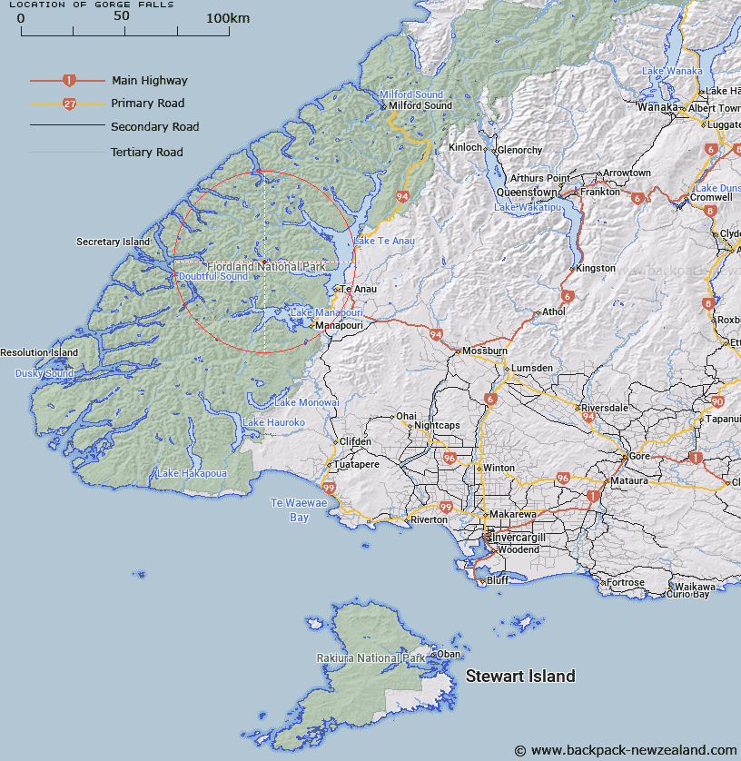
Gorge Falls Map New Zealand


New Zealand places in our database
[ A ] [ B ] [ C ] [ D ] [ E ] [ F ] [ G ] [ H ] [ I ] [ J ] [ K ] [ L ] [ M ] [ N ] [ O ] [ P ] [ Q ] [ R ] [ S ] [ T ] [ U ] [ V ] [ W ] [ X ] [ Y ] [ Z ]


Closest 20 Waterfalls to Gorge Falls

Ranfurly Falls ( 7.71km )   Wisely Falls ( 9.15km )   Stevens Falls ( 10.29km )   Bedivere Falls ( 12.41km )   Dorizac Falls ( 17.5km )   Ribbon Falls ( 19.28km )   Barrier Falls ( 20.72km )   Alderson Falls ( 24.58km )   Marjorie Falls ( 25.47km )   Lady Alice Falls ( 26.5km )   Helena Falls ( 26.66km )   Browne Falls ( 28.21km )   Huntleigh Falls ( 29.17km )   Twin Falls ( 30.76km )   Cleve Garth Falls ( 30.77km )   Shirley Falls ( 31.03km )   Alice Falls ( 36.36km )   Rebecca Falls ( 44.4km )   Clark Cascade ( 49.08km )   Saint Marys Falls ( 50.8km )   Ida Mary Waterfall ( 55.01km )   Hirere Falls ( 58.81km )   Saint Quintin Falls ( 60.53km )   Sutherland Falls ( 60.9km )   Staircase Rapids ( 62.13km )   Flower Fall ( 64.28km )   Bowmar Falls ( 66.76km )   Mackay Falls ( 69.85km )   Melita Falls ( 70.85km )   Christie Falls ( 74.65km )   Giant Gate Falls ( 74.71km )   De Lambert Falls ( 76.38km )   Camp Oven Falls ( 77.78km )   Lyttle Falls ( 78.72km )   Hoani Falls ( 79.48km )   Earland Falls ( 80.29km )   McKenzie Falls ( 80.29km )   Bowen Falls ( 81.25km )   Cora Lynn Falls ( 83.6km )   Stirling Falls ( 84.82km )