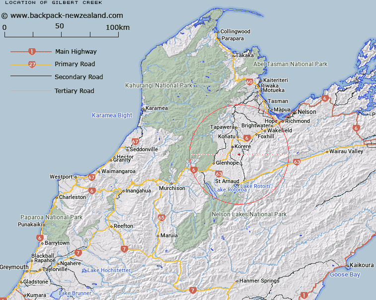
Map showing location of Gilbert Creek


LINZ description: Feature shown on: NZMS260 N28 Edition 1 1987
Latitude: -41.583167
Longitude: 172.846028
Northing: 5396491.2
Easting: 1587165.5
Land District: Nelson
Feat Type: Stream


Scroll down to see a more detailed road map and below that a topographical map showing the location of Gilbert Creek. The road map has been supplied by openstreetmap and the topographical map of Gilbert Creek has been supplied by Land Information New Zealand (LINZ).

Yes you can use the top static map for you school/university project or personal website with a link back. Contact me for any commercial use.
Gilbert Creek Map New Zealand


New Zealand places in our database
[ A ] [ B ] [ C ] [ D ] [ E ] [ F ] [ G ] [ H ] [ I ] [ J ] [ K ] [ L ] [ M ] [ N ] [ O ] [ P ] [ Q ] [ R ] [ S ] [ T ] [ U ] [ V ] [ W ] [ X ] [ Y ] [ Z ]


Closest 20 Streams to Gilbert Creek

Buster Creek ( 0.84km )   Rough'ns Creek ( 1.65km )   Gordon Creek ( 4.39km )   Thompson Creek ( 4.75km )   Motupiko River ( 5.1km )   Reays Valley Stream ( 5.63km )   Brewerton Creek Left Branch ( 5.83km )   Brewerton Creek ( 5.84km )   Ted Creek ( 6.5km )   Rainy River ( 6.52km )   Long Gully Stream ( 7.4km )   Graham Creek ( 7.58km )   Blue Glen Creek ( 7.68km )   Clark River ( 8.34km )   Smith Gully Stream ( 8.81km )   Kakariki Creek ( 9.06km )   Sandy Creek ( 9.43km )   Kikiwa Stream ( 9.56km )   Donald Creek ( 9.71km )   North Creek ( 9.98km )   Brough Creek ( 11.08km )   Motueka River Left Branch ( 11.34km )   Cat Creek ( 11.71km )   Kiwi Creek ( 11.88km )   Norris Gully Stream ( 12.02km )   Norriss Gully Stream ( 12.02km )   Porter Creek ( 12.59km )   Ellis Stream ( 12.76km )   Gay Creek ( 12.96km )   Kiwi Creek ( 13.09km )   Railway Gully Stream ( 13.23km )   Monte Creek ( 13.33km )   Tadmor River ( 13.33km )   Burmeister Stream ( 13.47km )   Stag Creek ( 13.5km )   Dun Creek ( 13.56km )   Sunday Creek ( 13.74km )   Alpine Creek ( 14.05km )   Kinzett Creek ( 14.2km )   Sherry River Left Branch ( 14.23km )