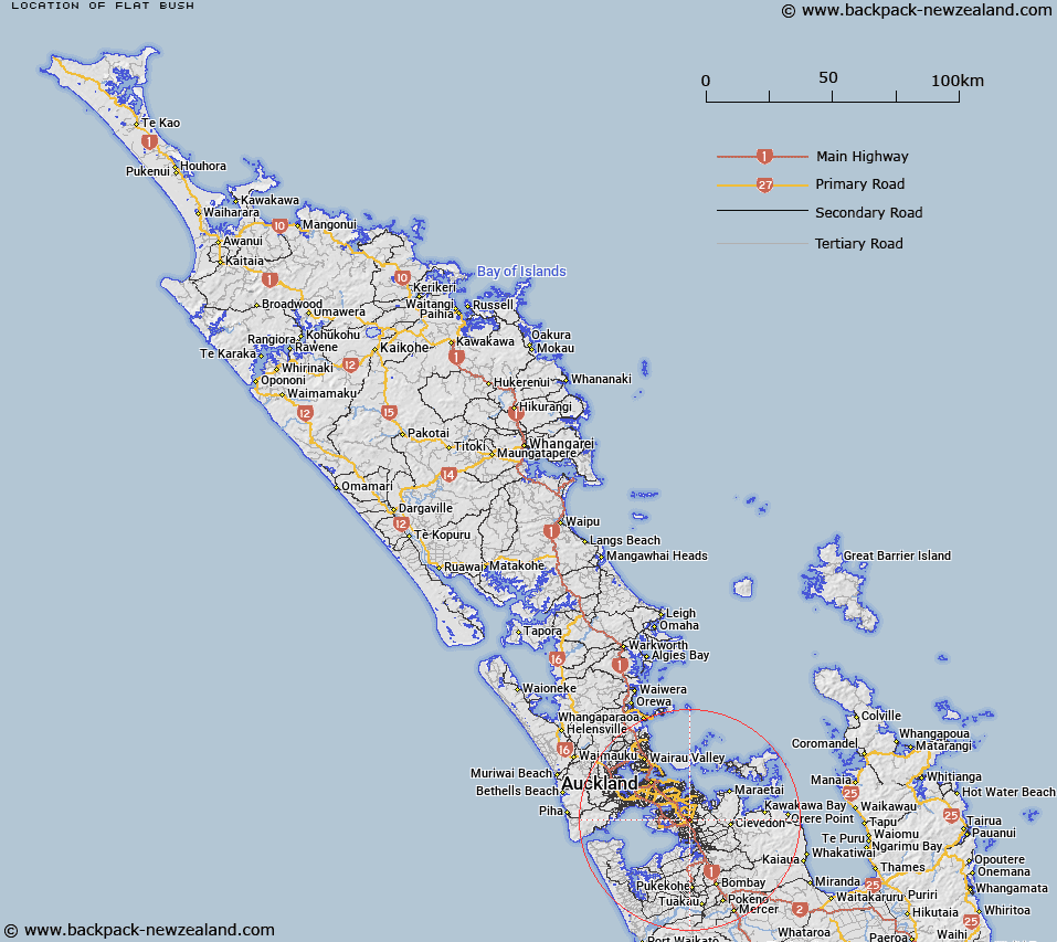
Map showing location of Flat Bush


LINZ description: New locality/town in Manukau City, generally bounded west by East Tamaki and Otara, north by East Tamaki Heights, east by low lying catchment hills, and south by Totara Heights.
Latitude: -36.976385
Longitude: 174.897461
Northing: 5906064.9
Easting: 1768889.4
Land District: North Auckland
Feat Type: Town


Scroll down to see a more detailed road map and below that a topographical map showing the location of Flat Bush. The road map has been supplied by openstreetmap and the topographical map of Flat Bush has been supplied by Land Information New Zealand (LINZ).

Yes you can use the top static map for you school/university project or personal website with a link back. Contact me for any commercial use.

Flat Bush Map New Zealand


New Zealand places in our database
[ A ] [ B ] [ C ] [ D ] [ E ] [ F ] [ G ] [ H ] [ I ] [ J ] [ K ] [ L ] [ M ] [ N ] [ O ] [ P ] [ Q ] [ R ] [ S ] [ T ] [ U ] [ V ] [ W ] [ X ] [ Y ] [ Z ]


Closest 20 Towns to Flat Bush

Otara ( 3.03km )   Papatoetoe ( 4.91km )   Manurewa ( 5.87km )   Otahuhu ( 6.14km )   Pakuranga ( 7.27km )   Papakura Military Camp ( 9.1km )   Mount Wellington ( 9.23km )   Howick ( 9.35km )   Papakura ( 11.24km )   Onehunga ( 11.56km )   Newmarket ( 15.63km )   Mount Roskill ( 15.85km )   Mount Eden ( 16.58km )   Auckland ( 18.29km )   Mount Albert ( 18.41km )   New Lynn ( 20.46km )   Glen Eden ( 23.26km )   Otau Crossing ( 24.82km )   Mackies Rest ( 24.94km )   Dickeys Landing ( 25.12km )   Kellys Landing ( 25.86km )   Otimai Camp ( 26.71km )   Mangatawhiri Crossing ( 26.84km )   Acheson Crossing ( 27.52km )   Swamp Crossing ( 27.67km )   Horne Crossing ( 28.21km )   Westheads Landing ( 28.49km )   Gordons Landing ( 28.85km )   Milnes Crossing ( 29.03km )   Mangatangi Fork ( 29.08km )   Thousand Acre Clearing ( 30.66km )   Nihotupu Auxiliary Reservoir ( 30.71km )   The Jews Clearing ( 32.43km )   Orange Peel Corner ( 33.6km )   Hamiltons Gap ( 34.31km )   Waitakerei ( 34.67km )   Waitakere ( 34.67km )   Cochranes Gap ( 34.92km )   McKenzie Junction ( 35.52km )   Ussher Cross ( 36km )