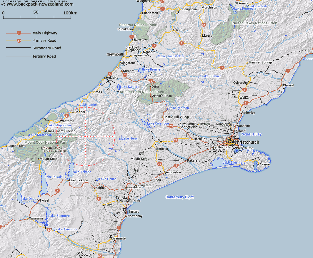
Map showing location of Darkey Jims Bush


LINZ description: Area of bush on eastern side of Havelock River opposite junction with Forbes River. Block II Havelock Survey District. Feature shown on: NZTopo50-BX17 148865
Latitude: -43.45009
Longitude: 170.714032
Northing: 5186663.3
Easting: 1415037.5
Land District: Canterbury
Feat Type: Bush


Scroll down to see a more detailed road map and below that a topographical map showing the location of Darkey Jims Bush. The road map has been supplied by openstreetmap and the topographical map of Darkey Jims Bush has been supplied by Land Information New Zealand (LINZ).

Yes you can use the top static map for you school/university project or personal website with a link back. Contact me for any commercial use.

Darkey Jims Bush Map New Zealand


New Zealand places in our database
[ A ] [ B ] [ C ] [ D ] [ E ] [ F ] [ G ] [ H ] [ I ] [ J ] [ K ] [ L ] [ M ] [ N ] [ O ] [ P ] [ Q ] [ R ] [ S ] [ T ] [ U ] [ V ] [ W ] [ X ] [ Y ] [ Z ]


Closest 20 Bushs to Darkey Jims Bush

Governors Bush ( 59.76km )   Burns Bush ( 65.46km )   Dennistoun Bush ( 66.08km )   Mills Bush ( 66.16km )   Thirteen Mile Bush ( 84.49km )   Teawapuhe Bush ( 96.07km )   Darts Bush ( 103.81km )   Firewood Bush ( 129.14km )   Little Green Bush ( 132.12km )   Green Island Bush ( 132.53km )   Hook Bush ( 134.31km )   Pigeon Bush ( 135.04km )   Gunns Bush ( 136.57km )   Kelceys Bush ( 140.01km )   Prendergasts Bush ( 155.07km )   Omahu Bush ( 155.07km )   Kidds Bush ( 159.74km )   Gills Bush ( 172.75km )   Home Bush ( 174.14km )   Cox Bush ( 182.4km )   Glencoe Bush ( 207.21km )   Big Bush ( 214.98km )   Wandle Bush ( 218.99km )   Settlers Bush ( 227.4km )   Cockburns Bush ( 231.62km )   T?tara Bush ( 238.26km )   Twelve Mile Bush ( 252.05km )   Dog Bush ( 259.22km )   Waikai? Bush ( 267.87km )   Mcewens Bush ( 270.27km )   Garretts Bush ( 270.54km )   Shirkers Bush ( 277.54km )   Quinney Bush ( 280.74km )   Peters Bush ( 280.95km )   Leithen Bush ( 289.49km )   Faulkners Bush ( 296.56km )   Baigents Bush ( 296.75km )   Max's Bush ( 302.92km )   Burwood Bush ( 311.17km )   Croydon Bush ( 324.86km )