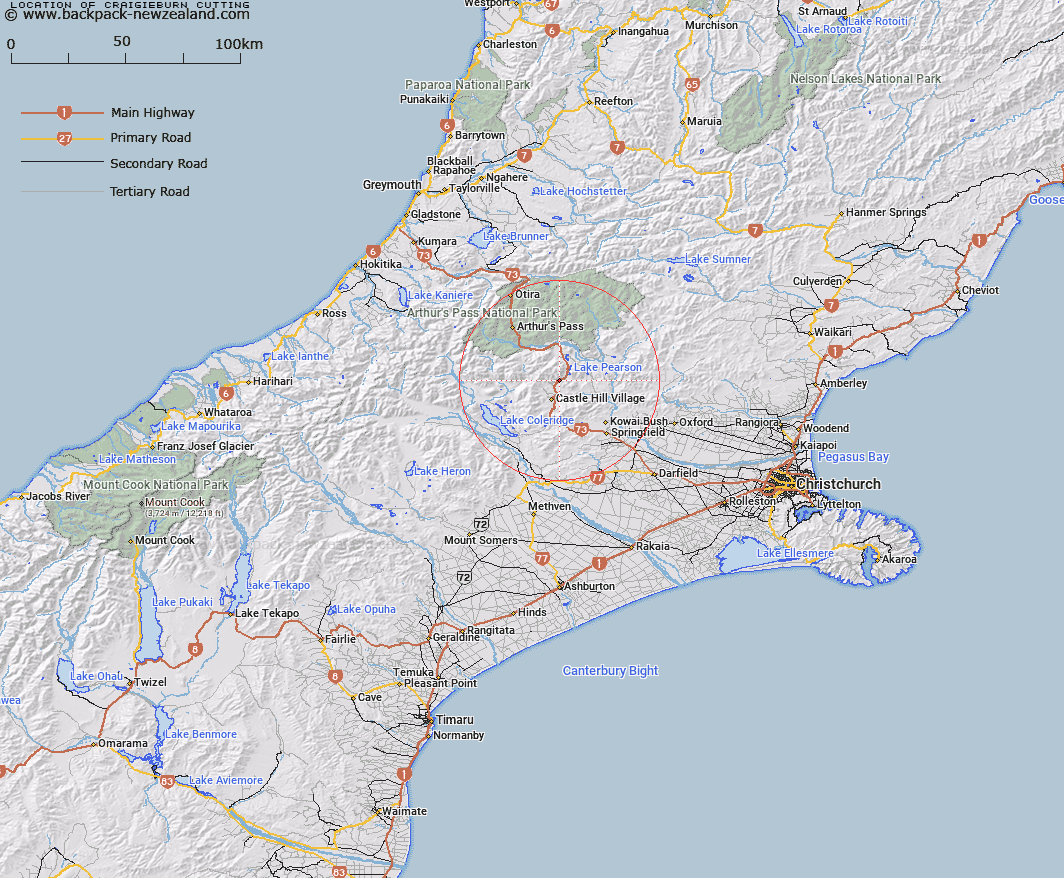
Map showing location of Craigieburn Cutting


LINZ description: Well known cutting on SH 73 to south of Flock Hill Station, a mile south west of Craigieburn Stream Bridge.
Latitude: -43.142487
Longitude: 171.746929
Northing: 5222600
Easting: 1498100
Land District: Canterbury
Feat Type: Valley


Scroll down to see a more detailed road map and below that a topographical map showing the location of Craigieburn Cutting. The road map has been supplied by openstreetmap and the topographical map of Craigieburn Cutting has been supplied by Land Information New Zealand (LINZ).

Yes you can use the top static map for you school/university project or personal website with a link back. Contact me for any commercial use.

Craigieburn Cutting Map New Zealand


New Zealand places in our database
[ A ] [ B ] [ C ] [ D ] [ E ] [ F ] [ G ] [ H ] [ I ] [ J ] [ K ] [ L ] [ M ] [ N ] [ O ] [ P ] [ Q ] [ R ] [ S ] [ T ] [ U ] [ V ] [ W ] [ X ] [ Y ] [ Z ]


Closest 20 Valleys to Craigieburn Cutting

Pylon Gully ( 12.54km )   Staircase Gully ( 15.36km )   Carrington Gorge ( 17.09km )   Otarama Gorge ( 20.57km )   Bishops Gully ( 24.43km )   Haircut Gully ( 26.82km )   McArthur Gorge ( 27.69km )   Black Hole ( 28.38km )   Bishops Gully ( 28.49km )   Otira Gorge ( 34.38km )   Terrible Gully ( 34.54km )   Jones Gully ( 34.97km )   Pipe Clay Gully ( 35.11km )   Tent Gully ( 35.49km )   Cleathings Valley ( 35.75km )   Knowles Gully ( 36.39km )   Surveyors Gully ( 38.07km )   Surveyors Gully ( 38.62km )   Cascade Glen ( 38.69km )   Oyster Gully ( 38.82km )   Rakaia Gorge ( 40.52km )   Camping Gully ( 40.62km )   Hervey Gorge ( 41.15km )   Mutton Gully ( 42.97km )   McElroy Gorge ( 43.56km )   Third Gorge ( 43.97km )   Seagull Gully ( 45.52km )   Tillers Gulch ( 46.16km )   Wooded Gully ( 48.08km )   Rough Gully ( 50.55km )   Boil Gully ( 50.75km )   Second Gorge ( 51.21km )   Whakarira Gorge ( 51.61km )   Soda Gully ( 52km )   Turkey Gully ( 52.5km )   Deer Wallow Gully ( 53.52km )   Frisco Canyon ( 54.5km )   Toaroha Canyon ( 55.09km )   Happy Valley ( 56.59km )   Boundary Gully ( 57.36km )