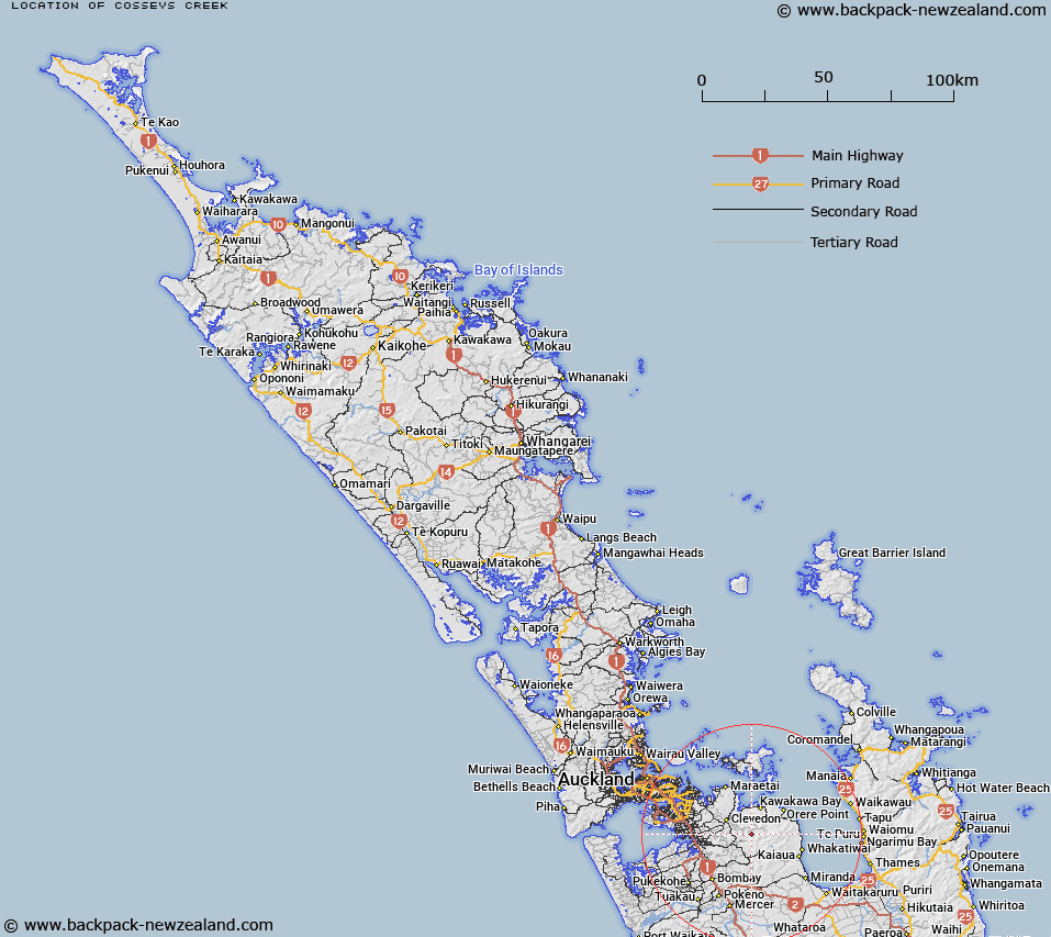
Map showing location of Cosseys Creek


LINZ description: Feature shown on: NZMS260 S11 Edition 2 1994
Latitude: -37.040778
Longitude: 175.1255
Northing: 5898491.4
Easting: 1789029.6
Land District: North Auckland
Feat Type: Stream


Scroll down to see a more detailed road map and below that a topographical map showing the location of Cosseys Creek. The road map has been supplied by openstreetmap and the topographical map of Cosseys Creek has been supplied by Land Information New Zealand (LINZ).

Yes you can use the top static map for you school/university project or personal website with a link back. Contact me for any commercial use.
Cosseys Creek Map New Zealand


New Zealand places in our database
[ A ] [ B ] [ C ] [ D ] [ E ] [ F ] [ G ] [ H ] [ I ] [ J ] [ K ] [ L ] [ M ] [ N ] [ O ] [ P ] [ Q ] [ R ] [ S ] [ T ] [ U ] [ V ] [ W ] [ X ] [ Y ] [ Z ]


Closest 20 Streams to Cosseys Creek

Maori Stream ( 1.74km )   Parker Stream ( 2.74km )   Quinn Stream ( 3.2km )   Saint Paul Stream ( 4.34km )   Lilburne Stream ( 5.9km )   Quartz Stream ( 6.32km )   Hunua Stream ( 6.32km )   Orere Stream ( 6.39km )   Konini Stream ( 6.51km )   Kiripaka Stream ( 6.76km )   Aroaro Stream ( 6.99km )   Tawa Stream ( 7.37km )   Acheson Stream ( 7.45km )   Tuawahine Stream ( 7.77km )   Rata Creek ( 7.78km )   Horne Stream ( 8.26km )   Kapoai Stream ( 8.59km )   Pukurau Stream ( 9.18km )   Milnes Stream ( 9.28km )   Scanlen Stream ( 9.32km )   Urungahauhau Stream ( 9.44km )   Tapapakanga Stream ( 9.48km )   Takirungarere Stream ( 9.54km )   Taitaia Stream ( 9.95km )   Wairoa River ( 10.1km )   Orere River ( 10.12km )   Tipakuri Stream ( 10.15km )   Rotopiro Stream ( 10.39km )   Hororua Stream ( 10.58km )   Rautawa Stream ( 10.82km )   Morearea Stream ( 10.92km )   Workman Stream ( 11.03km )   Mangawheau Stream ( 11.35km )   Sharp Stream ( 11.38km )   Kurakuranui Stream ( 11.93km )   Kauri Stream ( 11.97km )   Waimang? Stream ( 12.17km )   Waimangu Stream ( 12.17km )   Culvert Stream ( 12.32km )   Hays Stream ( 12.34km )