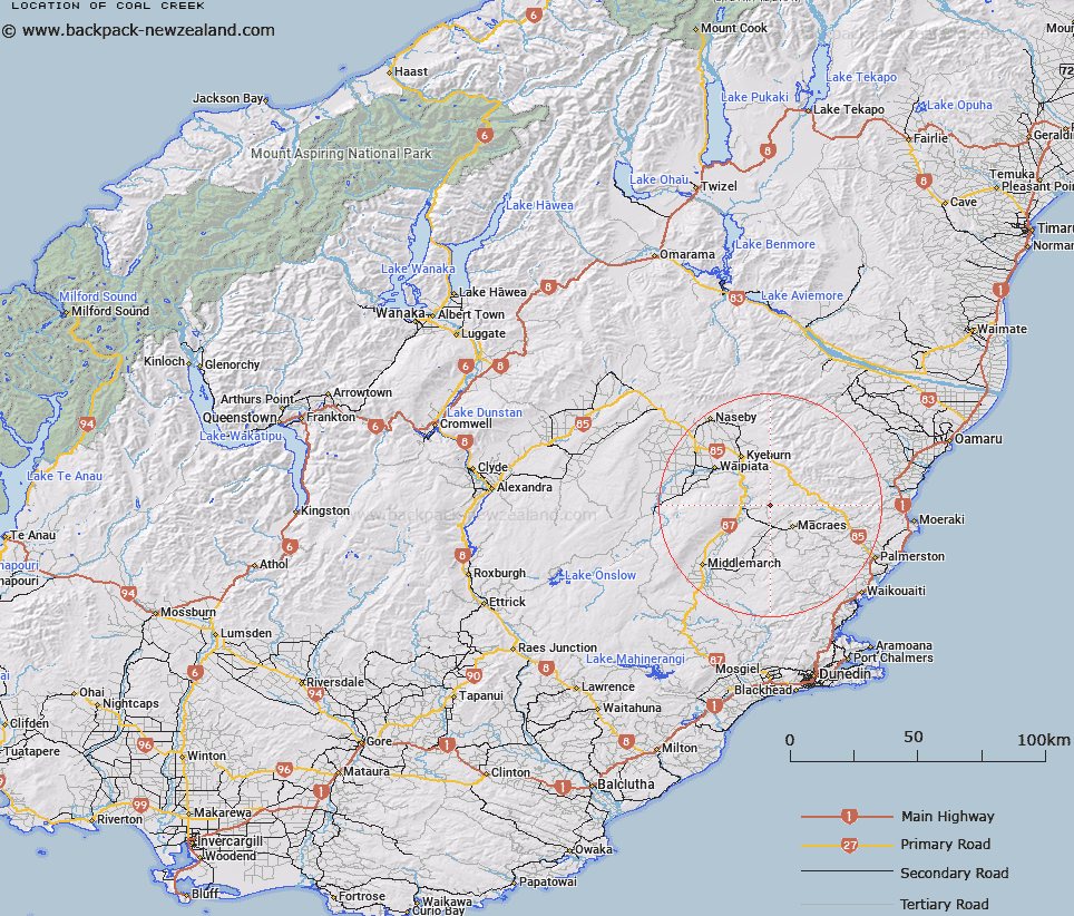
Map showing location of Coal Creek


LINZ description: Feature shown on: NZMS260 I42 Edition 1 1984 Limited Revision 1996
Latitude: -45.311282
Longitude: 170.353705
Northing: 4979062.3
Easting: 1392564.6
Land District: Otago
Feat Type: Stream


Scroll down to see a more detailed road map and below that a topographical map showing the location of Coal Creek. The road map has been supplied by openstreetmap and the topographical map of Coal Creek has been supplied by Land Information New Zealand (LINZ).

Yes you can use the top static map for you school/university project or personal website with a link back. Contact me for any commercial use.
Coal Creek Map New Zealand


New Zealand places in our database
[ A ] [ B ] [ C ] [ D ] [ E ] [ F ] [ G ] [ H ] [ I ] [ J ] [ K ] [ L ] [ M ] [ N ] [ O ] [ P ] [ Q ] [ R ] [ S ] [ T ] [ U ] [ V ] [ W ] [ X ] [ Y ] [ Z ]


Closest 20 Streams to Coal Creek

Maori Hen Creek ( 2.28km )   Mare Burn ( 2.73km )   Welshmans Creek ( 4.1km )   Fullarton Stream ( 4.55km )   Wild Dog Creek ( 4.61km )   Highlay Creek ( 6.5km )   Filly Burn ( 7.36km )   Bushy Creek ( 7.84km )   Horse Burn ( 8.27km )   Shepherds Creek ( 8.41km )   Prices Creek ( 8.76km )   Coal Creek ( 8.94km )   Homestead Creek ( 9.57km )   Deepdell Creek ( 9.67km )   Coal Creek ( 10.79km )   Scrub Burn ( 11km )   Shingly Creek ( 11.14km )   Goat Burn ( 11.38km )   Huntley Creek ( 11.56km )   Six Mile Creek ( 12.29km )   Cranky Jims Creek ( 12.56km )   Gills Creek ( 13.06km )   Wee Cap Burn ( 13.13km )   Hound Burn ( 13.31km )   Green Valley Creek ( 13.38km )   Boundary Creek ( 13.82km )   Cap Burn ( 13.86km )   Pigroot Creek ( 14.23km )   Tipperary Creek ( 14.4km )   Annetts Creek ( 14.5km )   Siberia Creek ( 14.79km )   House Creek ( 15.19km )   Waddells Creek ( 15.44km )   Heeney Creek ( 15.52km )   Heaney Creek ( 15.52km )   Happy Valley Creek ( 15.73km )   Jimmys Creek ( 15.93km )   Last Creek ( 16.37km )   Murphys Creek ( 16.93km )   Hellene Creek ( 17.07km )