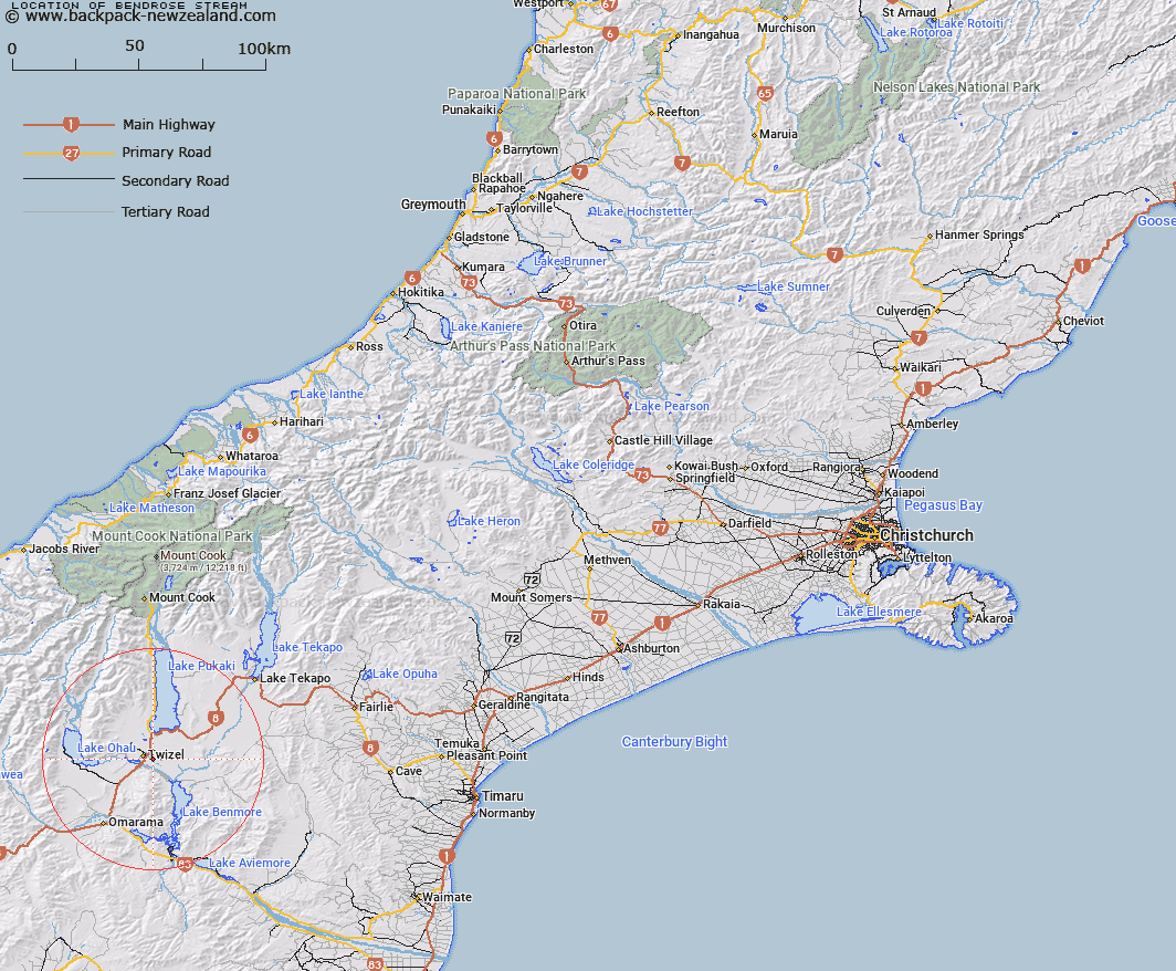
Map showing location of Bendrose Stream


LINZ description: Stream flows south and parallel to Twizel River through Bendrose Run and joins Twizel River about 5km from its junction with Ohau River.
Latitude: -44.26996
Longitude: 170.130592
Northing: 5094138
Easting: 1370990.9
Land District: Canterbury
Feat Type: Stream


Scroll down to see a more detailed road map and below that a topographical map showing the location of Bendrose Stream. The road map has been supplied by openstreetmap and the topographical map of Bendrose Stream has been supplied by Land Information New Zealand (LINZ).

Yes you can use the top static map for you school/university project or personal website with a link back. Contact me for any commercial use.

Bendrose Stream Map New Zealand


New Zealand places in our database
[ A ] [ B ] [ C ] [ D ] [ E ] [ F ] [ G ] [ H ] [ I ] [ J ] [ K ] [ L ] [ M ] [ N ] [ O ] [ P ] [ Q ] [ R ] [ S ] [ T ] [ U ] [ V ] [ W ] [ X ] [ Y ] [ Z ]


Closest 20 Streams to Bendrose Stream

Pukaki River ( 5.92km )   Wairepo Creek ( 7.39km )   Pukaki Canal ( 8.07km )   Tay Stream ( 8.38km )   Tekapo River ( 9.27km )   Spring Creek ( 10.67km )   Barclays Creek ( 11.16km )   Fraser Stream ( 12.42km )   Scrubby Creek ( 12.63km )   Ohau Canal ( 12.63km )   Dry Stream ( 13.12km )   Temple Creek ( 13.25km )   Ohau River ( 13.32km )   Camp Creek ( 13.36km )   Darts Bush Stream ( 13.94km )   Falstone Creek ( 15.31km )   Stony River ( 16.1km )   Twizel River ( 18.39km )   Gladstone Stream ( 18.45km )   Jack Steel Stream ( 18.46km )   Gretas Stream ( 18.9km )   McMillan Stream ( 19.55km )   Dorcy Stream ( 19.64km )   Big Rock Stream ( 20.18km )   Tekapo Canal ( 20.74km )   Sutherlands Creek ( 20.99km )   Shepherds Creek ( 21.29km )   Ross Stream ( 22.08km )   Six Mile Creek ( 22.17km )   Silver Creek ( 22.2km )   Top McMillan Stream ( 22.23km )   Maori Creek ( 22.34km )   Black Forest Stream ( 22.42km )   Totara Creek ( 23.07km )   Harris Stream ( 23.08km )   Staircase Stream ( 23.26km )   Coal Creek ( 23.58km )   Mackenzie Stream ( 23.7km )   Serpentine Creek ( 24.13km )   Maryburn Fill ( 24.4km )