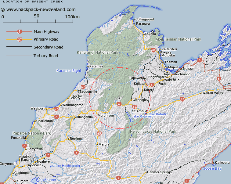
Map showing location of Baigent Creek


LINZ description: Joins Owen River on the right bank 1km south-west of confluence of the Owen and Fyfe Rivers. Matiri Survey District.
Latitude: -41.624934
Longitude: 172.504787
Northing: 5391747.1
Easting: 1558747.6
Land District: Nelson
Feat Type: Stream


Scroll down to see a more detailed road map and below that a topographical map showing the location of Baigent Creek. The road map has been supplied by openstreetmap and the topographical map of Baigent Creek has been supplied by Land Information New Zealand (LINZ).

Yes you can use the top static map for you school/university project or personal website with a link back. Contact me for any commercial use.

Baigent Creek Map New Zealand


New Zealand places in our database
[ A ] [ B ] [ C ] [ D ] [ E ] [ F ] [ G ] [ H ] [ I ] [ J ] [ K ] [ L ] [ M ] [ N ] [ O ] [ P ] [ Q ] [ R ] [ S ] [ T ] [ U ] [ V ] [ W ] [ X ] [ Y ] [ Z ]


Closest 20 Streams to Baigent Creek

Frying Pan Creek ( 1.53km )   Sandstone Creek ( 1.91km )   Owen River ( 1.95km )   Fire Creek ( 2.32km )   Fyfe River ( 2.69km )   Maggie Creek ( 2.87km )   Carrol Creek ( 3.59km )   Brewery Creek ( 3.86km )   Advance Creek ( 4.09km )   Zealandia Creek ( 4.4km )   East Branch Johnston Creek ( 4.57km )   Coal Creek ( 4.73km )   Carton Creek ( 4.77km )   Johnston Creek ( 4.9km )   Halfway Creek ( 4.96km )   Spring Creek ( 5.21km )   Deep Creek ( 5.25km )   Uno Creek ( 5.32km )   Murray Creek ( 5.33km )   Bulmer Creek ( 5.54km )   League Creek ( 5.76km )   Caledonian Creek ( 6.44km )   West Branch Johnston Creek ( 7km )   Two Mile Creek ( 7.05km )   Sluice Box Creek ( 7.17km )   Coal Creek ( 7.92km )   Three Mile Creek ( 8.1km )   Grassy Creek ( 8.35km )   Granity Creek ( 8.93km )   Handrail Creek ( 9.34km )   Trent Stream ( 9.52km )   Washout Creek ( 9.73km )   Matiri River ( 12.4km )   Hope River ( 12.71km )   Claybank Creek ( 12.76km )   Cow Creek ( 13.33km )   Bull Creek ( 13.66km )   Nuggety Creek ( 13.76km )   Scotty Creek ( 13.95km )   Little Hope River ( 14.04km )