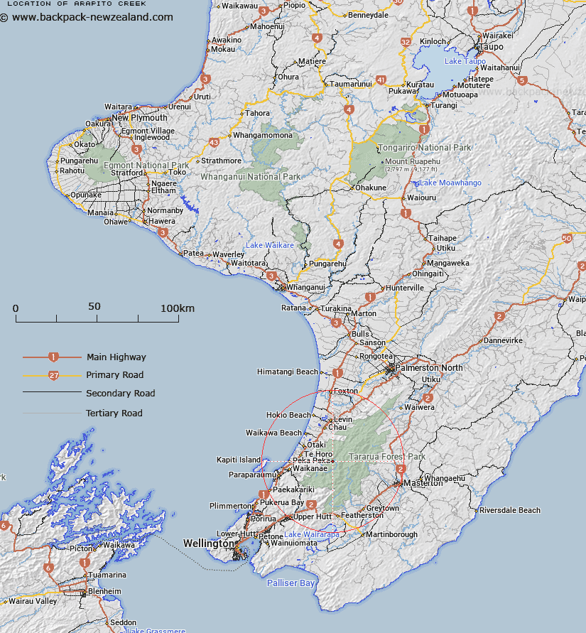
Map showing location of Arapito Creek


LINZ description: Right bank tributary of the Otaki River rising North-east of Plateau, flowing North-westward and joining Otaki River 1.1km South by South-west of Waitewaewae Otaki Forks. Blocks V and VI Taungata Survey District.
Latitude: -40.834792
Longitude: 175.297126
Northing: 5477042.9
Easting: 1793681
Land District: Wellington
Feat Type: Stream


Scroll down to see a more detailed road map and below that a topographical map showing the location of Arapito Creek. The road map has been supplied by openstreetmap and the topographical map of Arapito Creek has been supplied by Land Information New Zealand (LINZ).

Yes you can use the top static map for you school/university project or personal website with a link back. Contact me for any commercial use.

Arapito Creek Map New Zealand


New Zealand places in our database
[ A ] [ B ] [ C ] [ D ] [ E ] [ F ] [ G ] [ H ] [ I ] [ J ] [ K ] [ L ] [ M ] [ N ] [ O ] [ P ] [ Q ] [ R ] [ S ] [ T ] [ U ] [ V ] [ W ] [ X ] [ Y ] [ Z ]


Closest 20 Streams to Arapito Creek

Boyd-Wilson Creek ( 0.99km )   Plateau Stream ( 2.26km )   Waitatapia Stream ( 2.28km )   Saddle Creek ( 2.96km )   Chaney Creek ( 3.38km )   Kahiwiroa Stream ( 3.43km )   Papa Creek ( 3.66km )   Waitewaewae River ( 3.74km )   Gorge Creek ( 5.1km )   Mick Stream ( 5.42km )   Aokaparangi Creek ( 5.58km )   East Waitewaewae River ( 5.84km )   West Waitewaewae Stream ( 6.17km )   Waitewaewae Stream ( 6.17km )   Crawford Creek ( 6.18km )   Whatiuru Creek ( 6.53km )   Prout Stream ( 6.61km )   Kelleher Creek ( 7.13km )   Kelliher Creek ( 7.13km )   Francis Creek ( 7.88km )   Angle Knob Creek ( 7.94km )   West Waitewaewae River ( 7.97km )   Pukehinau Stream ( 8km )   Muir Creek ( 8.88km )   Sheridan Creek ( 9.02km )   Murray Creek ( 9.24km )   Waiotauru River ( 9.43km )   Park River ( 9.53km )   Penn Creek ( 9.69km )   Puketoro Stream ( 9.69km )   Maungahuka Stream ( 9.75km )   Mangahuka Stream ( 9.75km )   Dorset Creek ( 10.11km )   Isabelle Creek ( 10.17km )   Pukeatua Stream (Roaring Meg) ( 10.85km )   Tarahanga Stream ( 10.91km )   Corkill Stream ( 10.95km )   Collie Creek ( 11.3km )   Tregear Creek ( 11.4km )   Hector River ( 11.48km )