Map showing location of Waitotara River


LINZ description: Feature shown on: NZMS260 R20 Edition 1 1984
Latitude: -39.441889
Longitude: 174.738667
Northing: 5632742.2
Easting: 1749617.7
Land District: Taranaki
Feat Type: Stream
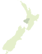

Scroll down to see a more detailed road map and below that a topographical map showing the location of Waitotara River. The road map has been supplied by openstreetmap and the topographical map of Waitotara River has been supplied by Land Information New Zealand (LINZ).

Yes you can use the top static map for you school/university project or personal website with a link back. Contact me for any commercial use.
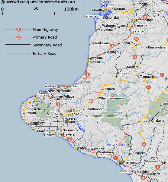
Waitotara River Map New Zealand


New Zealand places in our database
[ A ] [ B ] [ C ] [ D ] [ E ] [ F ] [ G ] [ H ] [ I ] [ J ] [ K ] [ L ] [ M ] [ N ] [ O ] [ P ] [ Q ] [ R ] [ S ] [ T ] [ U ] [ V ] [ W ] [ X ] [ Y ] [ Z ]


Closest 20 Streams to Waitotara River

Parira Stream ( 1.54km )   Omaru Stream ( 4.7km )   Whatiwhati Stream ( 4.97km )   Owhironui Stream ( 5.57km )   Moeawatea Stream ( 5.9km )   Tuituiaporua Stream ( 7.11km )   Paddock Stream ( 7.28km )   Pungarehunui Stream ( 7.9km )   Waitohikura Stream ( 8.2km )   Totara Stream ( 8.25km )   Tewaiporua Stream ( 8.27km )   Waireporepo Stream ( 9.03km )   Whakauahi Stream ( 10.14km )   Otawhiti Stream ( 10.66km )   Tunapoto Stream ( 10.78km )   Pouri Stream ( 11.69km )   Kotekiekie Stream ( 12.13km )   Pokeka Stream ( 12.29km )   Waipapa Stream ( 12.39km )   Kiwi Stream ( 12.39km )   Tunapapa Stream ( 12.59km )   Waihora Stream ( 12.67km )   Pouri Stream East Branch ( 12.73km )   Tahunamaere Stream ( 13.36km )   Aruhiroa Stream ( 13.72km )   Pine Stream ( 13.73km )   Whenuakura River ( 14.73km )   Matemate Stream ( 15.09km )   Mangaone Stream ( 15.19km )   Puniwhakau Stream ( 15.39km )   Mangaio Stream ( 15.4km )   Pleasant Stream ( 15.8km )   Whareau Stream ( 15.8km )   Kaitieke Stream ( 15.86km )   Tawhiti Stream ( 15.93km )   Mangapapa Stream ( 16.08km )   Mangamingi Stream ( 16.27km )   Omara Stream ( 16.48km )   Mangatukituki Stream ( 16.98km )   Mangawaiiti West Branch ( 17.47km )