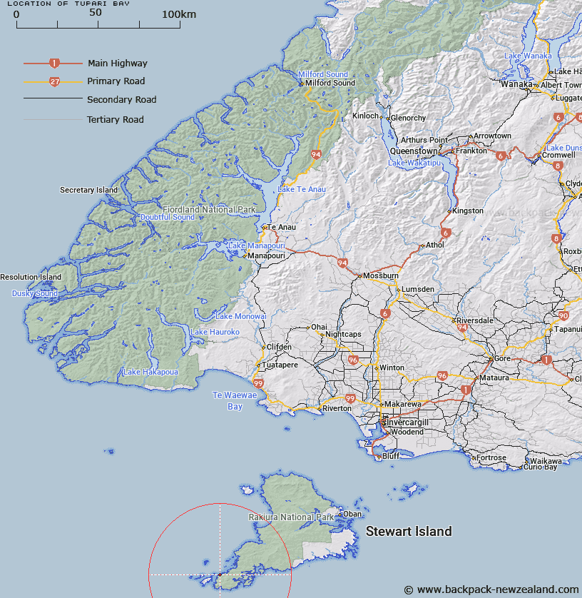
Map showing location of Tupari Bay


LINZ description: Bay on west coast, Stewart Island, facing toward Kaimohu Island, 8km North of South West Cape. South Cape Survey District.
Latitude: -47.210119
Longitude: 167.482157
Northing: 4756700
Easting: 1182200
Land District: Southland
Feat Type: Bay


Scroll down to see a more detailed road map and below that a topographical map showing the location of Tupari Bay. The road map has been supplied by openstreetmap and the topographical map of Tupari Bay has been supplied by Land Information New Zealand (LINZ).

Yes you can use the top static map for you school/university project or personal website with a link back. Contact me for any commercial use.

Tupari Bay Map New Zealand


New Zealand places in our database
[ A ] [ B ] [ C ] [ D ] [ E ] [ F ] [ G ] [ H ] [ I ] [ J ] [ K ] [ L ] [ M ] [ N ] [ O ] [ P ] [ Q ] [ R ] [ S ] [ T ] [ U ] [ V ] [ W ] [ X ] [ Y ] [ Z ]


Closest 20 Bays to Tupari Bay

Bats Cave ( 3.67km )   Patupahe Bay ( 4.55km )   Nicholson Harbour ( 5.07km )   Nichol Harbour ( 5.07km )   Murderers Cove ( 6.01km )   Te Weheka ( 6.29km )   Sylvan Cove ( 6.33km )   Boat Harbour ( 6.54km )   Flour Cask Bay ( 6.84km )   False Easy Harbour ( 8.47km )   Easy Harbour ( 8.86km )   Easy Cove ( 8.86km )   Burial Cove ( 9.12km )   Shipbuilders Cove ( 9.3km )   Rewa Bay ( 9.39km )   Puwai Bay ( 9.41km )   South Arm ( 9.51km )   Broad Bay ( 10.17km )   Cook Arm ( 10.24km )   Evening Cove ( 10.84km )   Disappointment Cove ( 11.13km )   Fright Cove ( 11.73km )   Islet Cove ( 12.07km )   Three Legged Woodhen ( 12.89km )   Sheathknife Bay ( 13.28km )   Small Craft Retreat ( 13.59km )   Acheron Anchorage ( 14.04km )   Bens Bay ( 14.56km )   Spar Cove ( 14.64km )   Bulling Bay ( 14.69km )   Albion Inlet ( 14.88km )   North Arm ( 16.47km )   Twilight Bay ( 17.23km )   Diprose Bay ( 18.13km )   Scout Bay ( 18.36km )   Mason Bay ( 37.54km )   Toitoi Bay ( 40.27km )   Big Kuri Bay ( 43.84km )   Kuri Bay ( 43.84km )   South West Arm ( 44.28km )