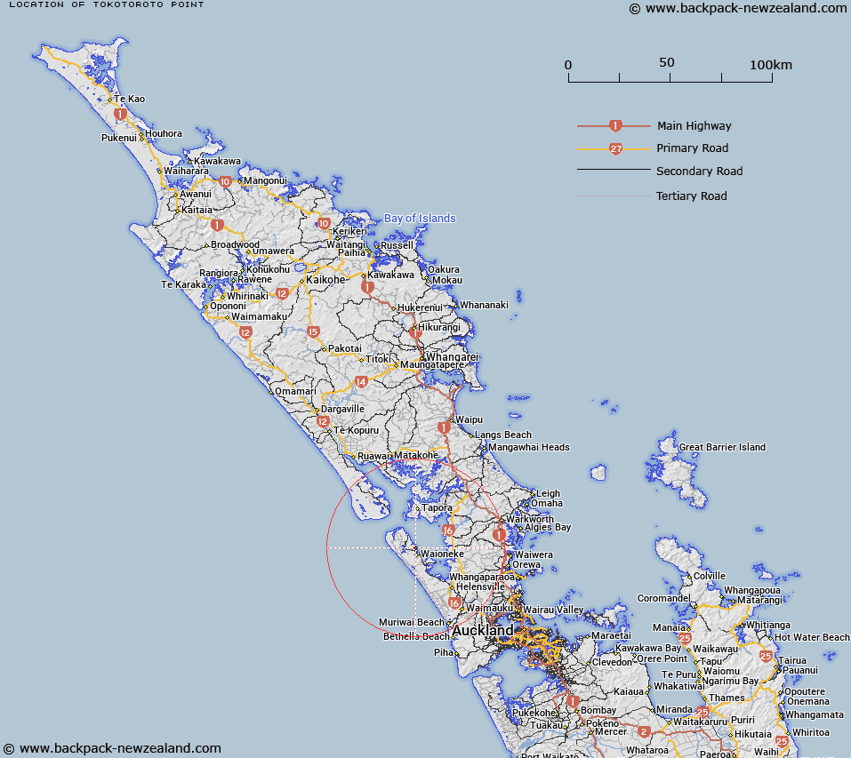
Map showing location of Tokotoroto Point


LINZ description: Feature shown on: NZMS260 Q09
Latitude: -36.510472
Longitude: 174.293667
Northing: 5958652.1
Easting: 1715842
Land District: North Auckland
Feat Type: Point


Scroll down to see a more detailed road map and below that a topographical map showing the location of Tokotoroto Point. The road map has been supplied by openstreetmap and the topographical map of Tokotoroto Point has been supplied by Land Information New Zealand (LINZ).

Yes you can use the top static map for you school/university project or personal website with a link back. Contact me for any commercial use.
Tokotoroto Point Map New Zealand


New Zealand places in our database
[ A ] [ B ] [ C ] [ D ] [ E ] [ F ] [ G ] [ H ] [ I ] [ J ] [ K ] [ L ] [ M ] [ N ] [ O ] [ P ] [ Q ] [ R ] [ S ] [ T ] [ U ] [ V ] [ W ] [ X ] [ Y ] [ Z ]


Closest 20 Points to Tokotoroto Point

Pararaha Point ( 4.87km )   Te Kawau Point ( 6.81km )   South Head ( 10.48km )   Kakanui Point ( 11.9km )   Orongo Point ( 12.43km )   Te Ngaio Point ( 13.31km )   Karaka Point ( 14.14km )   Oyster Point ( 14.15km )   Breach Point ( 15.22km )   Pouto Point ( 19.26km )   Kaipara Head ( 19.73km )   Schnapper Point ( 22.02km )   Motukumara Point ( 24.01km )   North Head ( 26.11km )   Pareotaunga Point ( 26.13km )   Gittos Point ( 26.3km )   Toetoe Point ( 27.25km )   Ngamotu Point ( 28.16km )   Te Kauri Point ( 28.31km )   Te Whau Point ( 28.41km )   Ru Point ( 28.69km )   Bushy Point ( 28.88km )   Puketi Point ( 29.94km )   Paparoa Point ( 30.29km )   Pakaurangi Point ( 30.32km )   Otara Head ( 30.4km )   Matihe Point (Beacon Point) ( 31.23km )   Owhareao Point ( 31.34km )   Ngaupiko Point ( 31.81km )   Te Ta Point ( 31.92km )   Te Whakarapa Point ( 32km )   Te Waro Point ( 32.55km )   Te Hoanga Point ( 32.59km )   Te Kopua Point ( 32.79km )   Whakapirau/Rocky Point ( 33.29km )   Rocky Point ( 33.29km )   Paparoa Point ( 34.71km )   Huarua Point ( 34.75km )   Island Point ( 35.25km )   Puriri Point ( 35.3km )