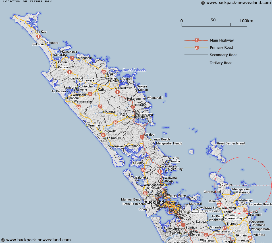
Map showing location of Titree Bay


LINZ description: Feature shown on: NZMS260 T10 U10 Edition 1 1983
Latitude: -36.636917
Longitude: 175.784361
Northing: 5941793.2
Easting: 1848942.9
Land District: North Auckland
Feat Type: Bay


Scroll down to see a more detailed road map and below that a topographical map showing the location of Titree Bay. The road map has been supplied by openstreetmap and the topographical map of Titree Bay has been supplied by Land Information New Zealand (LINZ).

Yes you can use the top static map for you school/university project or personal website with a link back. Contact me for any commercial use.
Titree Bay Map New Zealand


New Zealand places in our database
[ A ] [ B ] [ C ] [ D ] [ E ] [ F ] [ G ] [ H ] [ I ] [ J ] [ K ] [ L ] [ M ] [ N ] [ O ] [ P ] [ Q ] [ R ] [ S ] [ T ] [ U ] [ V ] [ W ] [ X ] [ Y ] [ Z ]


Closest 20 Bays to Titree Bay

Bumper Cove ( 0.46km )   Momona Bay ( 0.64km )   Whaler Cove ( 1.2km )   Peachgrove Bay ( 2.1km )   Onepoto Bay ( 2.89km )   Parapara Bay ( 3.6km )   Te Koru Bay ( 3.6km )   Coralie Bay ( 3.64km )   Te Whanga Bay ( 4.54km )   Huruhi Harbour ( 4.67km )   Rocky Bay ( 4.99km )   Whaorei Bay ( 6.98km )   Opito Bay ( 8.43km )   Red Bay ( 10.82km )   Matapaua Bay ( 11.63km )   Sandy Bay ( 11.77km )   Humbug Bay ( 12.02km )   Horseshoe Bay ( 12.52km )   Double Bay ( 13.26km )   Waitaia Bay ( 13.93km )   Von Luckners Cove ( 14.09km )   Wainuiototo Bay ( 17.1km )   Whangapoua Harbour ( 17.7km )   Te Kapoai Bay ( 18.9km )   Mercury Bay ( 19.55km )   Taiharuru Bay ( 19.71km )   Kennedy Bay ( 19.91km )   Cathedral Cove ( 21.24km )   Mares Leg Cove ( 21.36km )   Little Bay ( 21.6km )   Stingray Bay ( 21.61km )   Gemstone Bay ( 21.7km )   Landing Block ( 21.73km )   Picnic Bay ( 21.75km )   Lonely Bay ( 21.77km )   Cooks Bay ( 21.93km )   Fairchild Bay ( 22.08km )   Maramaratotara Bay ( 22.18km )   Moko Bay ( 22.21km )   Flaxmill Bay ( 22.29km )