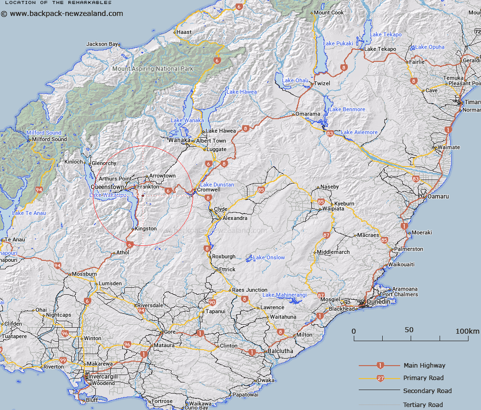
Map showing location of The Remarkables


LINZ description: Portion of Hector Mountains bounded on west by Lake Wakatipu, Kawarau River on the north, Wye Creek on the south and south-east and Rastus Burn on the north-east. More particularly the escarpment as viewed from Queenstown
Latitude: -45.085047
Longitude: 168.797971
Northing: 4999006.7
Easting: 1269306.7
Land District: Otago
Feat Type: Range


Scroll down to see a more detailed road map and below that a topographical map showing the location of The Remarkables. The road map has been supplied by openstreetmap and the topographical map of The Remarkables has been supplied by Land Information New Zealand (LINZ).

Yes you can use the top static map for you school/university project or personal website with a link back. Contact me for any commercial use.

The Remarkables Map New Zealand


New Zealand places in our database
[ A ] [ B ] [ C ] [ D ] [ E ] [ F ] [ G ] [ H ] [ I ] [ J ] [ K ] [ L ] [ M ] [ N ] [ O ] [ P ] [ Q ] [ R ] [ S ] [ T ] [ U ] [ V ] [ W ] [ X ] [ Y ] [ Z ]


Closest 20 Ranges to The Remarkables

Bayonet Peaks ( 12.72km )   The Horn Range ( 15.81km )   Crown Range ( 18.08km )   Carrick Range ( 20.88km )   Hector Mountains ( 23.12km )   Tapuae-o-Uenuku / Hector Mountains ( 23.12km )   Rough Peaks ( 24km )   Twenty Five Mile Range ( 24.72km )   Old Woman Range ( 27.58km )   Symmetry Peaks ( 27.92km )   Harris Mountains ( 30.43km )   Fern Hills ( 31.55km )   Round Peaks ( 35.23km )   Cairnmuir Mountains ( 35.26km )   Pisa Range ( 36.52km )   Eyre Mountains ( 37.55km )   Obelisk Range ( 39.81km )   Thomson Mountains ( 40.85km )   Old Man Range/Kopuwai ( 41.89km )   Old Man Range ( 41.89km )   Garvie Mountains ( 42.28km )   Criffel Range ( 42.34km )   Richardson Mountains ( 45.16km )   Dunstan Mountains ( 46.89km )   Slate Range ( 50.82km )   Helen Peaks ( 52.42km )   Clare Hills ( 52.57km )   Centaur Peaks ( 53.24km )   Merton Hills ( 54.13km )   Livingstone Mountains ( 56.04km )   Magdalen Hills ( 57.3km )   Ailsa Mountains ( 58.86km )   Humboldt Mountains ( 59.02km )   Countess Range ( 59.59km )   Knobby Range ( 59.87km )   Buchanan Peaks ( 60.63km )   Umbrella Mountains ( 61.04km )   Whitecoomb Range ( 61.52km )   Crawford Hills ( 61.63km )   Dunton Range ( 63.13km )