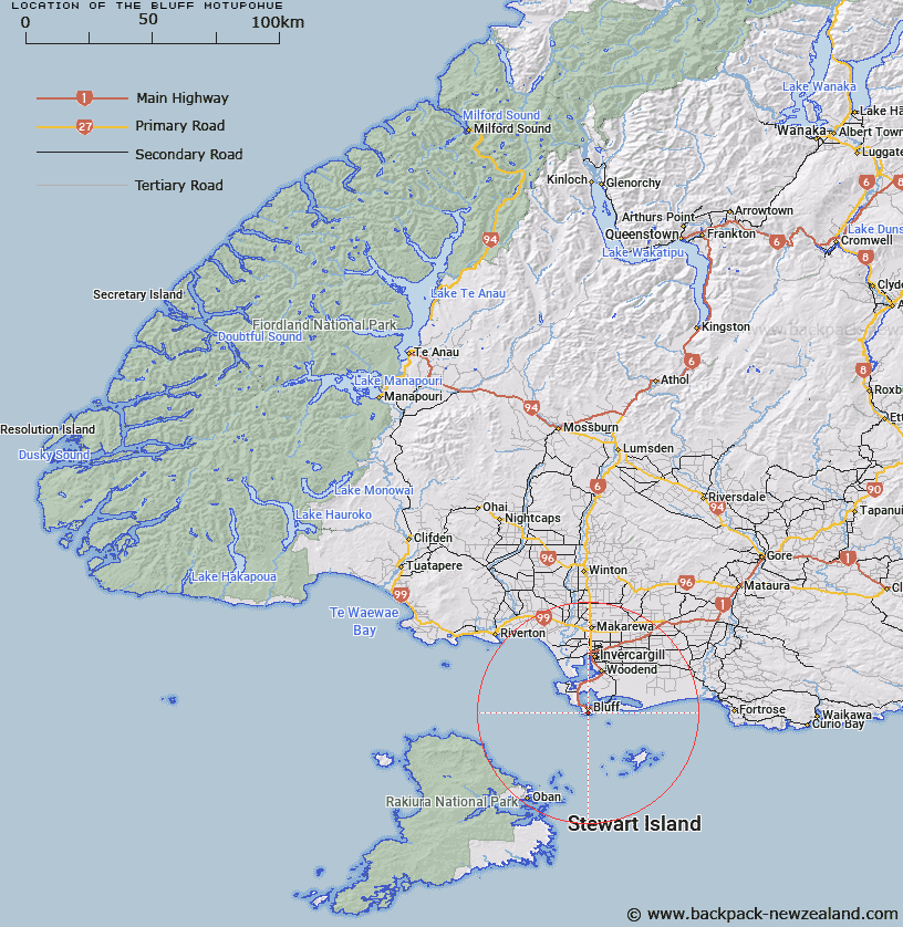
Map showing location of The Bluff/Motupōhue


LINZ description: Feature shown on: NZMS260-E47 528891; NZTopo50-CH10 430270;
Latitude: -46.615095
Longitude: 168.338547
Northing: 4827044.7
Easting: 1243095.4
Land District: Southland
Feat Type: Hill


Scroll down to see a more detailed road map and below that a topographical map showing the location of The Bluff/Motupōhue. The road map has been supplied by openstreetmap and the topographical map of The Bluff/Motupōhue has been supplied by Land Information New Zealand (LINZ).

Yes you can use the top static map for you school/university project or personal website with a link back. Contact me for any commercial use.

The Bluff/Motupōhue Map New Zealand


New Zealand places in our database
[ A ] [ B ] [ C ] [ D ] [ E ] [ F ] [ G ] [ H ] [ I ] [ J ] [ K ] [ L ] [ M ] [ N ] [ O ] [ P ] [ Q ] [ R ] [ S ] [ T ] [ U ] [ V ] [ W ] [ X ] [ Y ] [ Z ]


Closest 20 Hills to The Bluff/Motupōhue

Flat Hill ( 5.49km )   Three Sisters ( 10.84km )   Magog Peak ( 31.95km )   Garden Mound ( 32.77km )   Little Mount Anglem ( 34.11km )   Stony Hill ( 34.61km )   The Paps ( 34.83km )   Mount Anglem ( 35.1km )   Mount Anglem/Hananui ( 35.1km )   Peterson Hill ( 35.45km )   Observation Rock ( 35.85km )   Jacks Hill ( 37.89km )   Rocky Mountain ( 40.23km )   Kuriwao Hill ( 43.67km )   Pryse Peak ( 44.19km )   Sharks Tooth Hill ( 45.06km )   Upper Island Hill ( 46.81km )   Benson Peak ( 48.58km )   Forest Hill ( 48.79km )   Pebbly Hill ( 48.88km )   Bald Hill ( 48.89km )   Fortification Hill ( 49.31km )   Mount Florence ( 49.36km )   Red Head Peak ( 49.93km )   Mount Rakeahua ( 50.51km )   Adventure Hill ( 50.73km )   Flamborough Head ( 51.34km )   Lower Island Hill ( 51.58km )   Island Hill ( 51.58km )   Mount Darby ( 52.77km )   Ruahine Hill ( 53.91km )   Big Sandhill ( 54.22km )   Round Hill ( 55.09km )   Winton Hill ( 55.4km )   Walkers Hill ( 55.82km )   Longwood ( 55.87km )   Mount Alexander ( 56.89km )   Traills Hill ( 57.45km )   Pahia Hill ( 58.3km )   Egremont ( 59.49km )