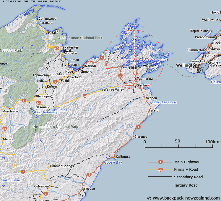
Map showing location of Te Mara Point


LINZ description: The coastal point at eastern end of Double Bay in Kenepuru Sound
Latitude: -41.186559
Longitude: 173.947667
Northing: 5440100
Easting: 1679475.6
Land District: Marlborough
Feat Type: Point


Scroll down to see a more detailed road map and below that a topographical map showing the location of Te Mara Point. The road map has been supplied by openstreetmap and the topographical map of Te Mara Point has been supplied by Land Information New Zealand (LINZ).

Yes you can use the top static map for you school/university project or personal website with a link back. Contact me for any commercial use.

Te Mara Point Map New Zealand


New Zealand places in our database
[ A ] [ B ] [ C ] [ D ] [ E ] [ F ] [ G ] [ H ] [ I ] [ J ] [ K ] [ L ] [ M ] [ N ] [ O ] [ P ] [ Q ] [ R ] [ S ] [ T ] [ U ] [ V ] [ W ] [ X ] [ Y ] [ Z ]


Closest 20 Points to Te Mara Point

Schnapper Point ( 1.71km )   Island Point ( 4.01km )   Weka Point ( 4.56km )   Poison Point ( 5.39km )   Kaiaho Point ( 5.81km )   Koutuwai Point ( 6.72km )   Okatiki Point ( 6.96km )   One Tree Point ( 7.13km )   Hautehoro Point ( 7.62km )   Torapapa Point ( 7.67km )   Houhou Point ( 7.7km )   Nohokouau Point ( 7.78km )   Puroa Point ( 7.84km )   Turn Point ( 8.22km )   Putanui Point ( 8.66km )   Iwituaroa Point ( 8.75km )   Ngakutu Point ( 8.92km )   Pihaka Point ( 9.04km )   Takaputira Point ( 9.04km )   Ngatawhetawheta Point ( 9.09km )   Kaireperepe Point ( 9.13km )   Momorangi Point ( 9.13km )   Iwirua Point ( 9.19km )   Whenuanui Point ( 9.19km )   Dillon Bell Point ( 9.29km )   Kaipakirikiri Point ( 9.53km )   Wedge Point ( 9.58km )   Kumutoto Point ( 9.61km )   Black Point ( 10.11km )   The Reef ( 10.13km )   Kaipupu Point ( 10.84km )   The Snout ( 11.06km )   Elephant Point ( 11.24km )   Stafford Point ( 11.33km )   McMahon Point ( 11.37km )   Capsize Point ( 11.44km )   Golden Point ( 11.72km )   Tunoamai Point ( 11.81km )   Karaka Point ( 12.2km )   Pariwhero Point ( 12.26km )