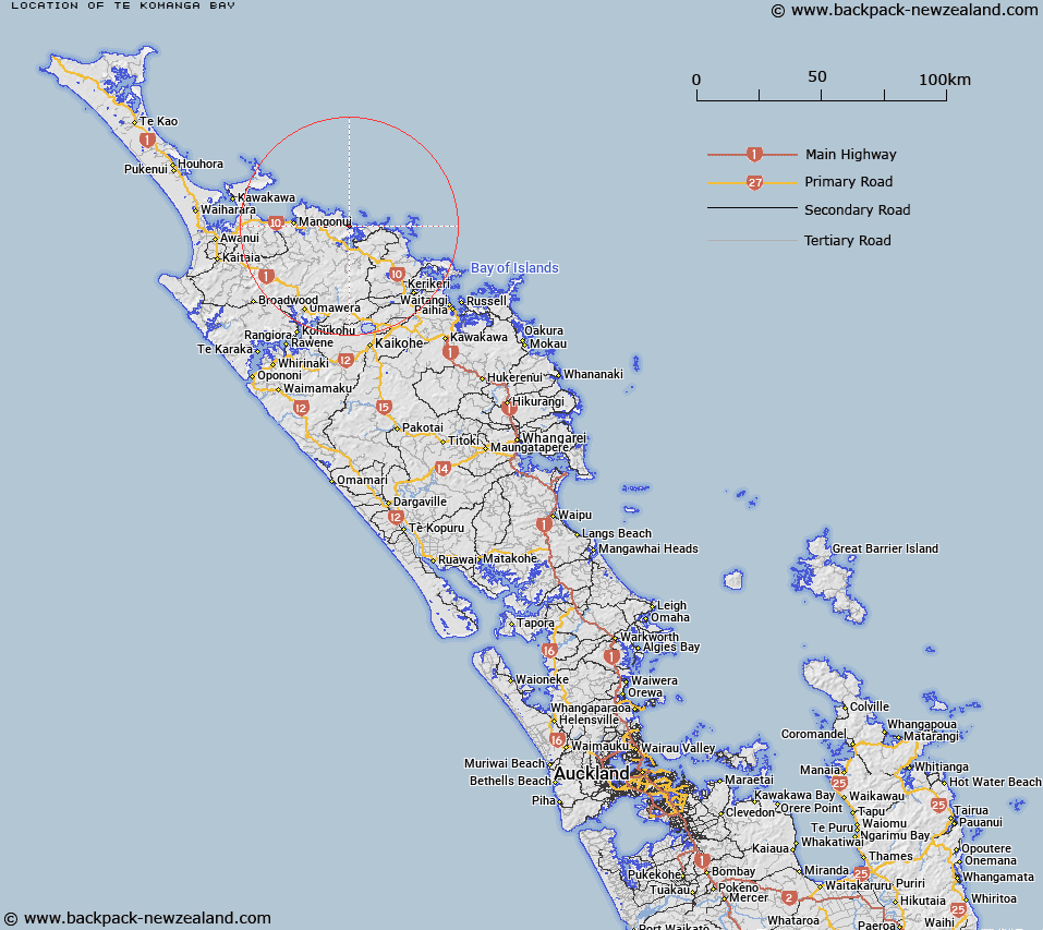
Map showing location of Te Komanga Bay


LINZ description: A small bay within Pekapeka bay between Waitepipī Bay and Te Rere Bay. NZTopo50-AU28 667264 to AU28 667261.
Latitude: -35.004264
Longitude: 173.729049
Northing: 6126241.3
Easting: 1666524.1
Land District: North Auckland
Feat Type: Bay


Scroll down to see a more detailed road map and below that a topographical map showing the location of Te Komanga Bay. The road map has been supplied by openstreetmap and the topographical map of Te Komanga Bay has been supplied by Land Information New Zealand (LINZ).

Yes you can use the top static map for you school/university project or personal website with a link back. Contact me for any commercial use.

Te Komanga Bay Map New Zealand


New Zealand places in our database
[ A ] [ B ] [ C ] [ D ] [ E ] [ F ] [ G ] [ H ] [ I ] [ J ] [ K ] [ L ] [ M ] [ N ] [ O ] [ P ] [ Q ] [ R ] [ S ] [ T ] [ U ] [ V ] [ W ] [ X ] [ Y ] [ Z ]


Closest 20 Bays to Te Komanga Bay

Waitepipi Bay ( 0.38km )   Waitepip? Bay ( 0.38km )   Te Rere Bay ( 0.51km )   Rere Bay ( 0.51km )   Pekapeka Bay ( 1.57km )   Taupo Bay (West Bay) ( 1.93km )   K?hatupap? / Ranfurly Bay ( 2.11km )   Ranfurly Bay ( 2.11km )   Waihi Bay ( 2.19km )   Waihe Bay ( 2.19km )   Okura Bay ( 3.55km )   Pararako Bay ( 3.89km )   Camp Bay ( 4.04km )   Tauranga Bay ( 4.23km )   Owhanga Bay ( 4.55km )   Owhatanga Bay ( 4.55km )   Whangaroa Bay ( 4.72km )   Frear Bay ( 5km )   Pumanawa Bay ( 5.08km )   Waitapu Bay ( 5.31km )   Whangaroa Harbour ( 5.67km )   Marble Bay ( 5.69km )   Touwai Bay ( 6.03km )   Tupou Bay ( 7.39km )   Whangaihe Bay ( 8.01km )   Waihapa Bay ( 8.17km )   East Bay ( 8.79km )   Motukahakaha Bay ( 9.08km )   Mahinepua Bay ( 10.62km )   Waimahana Bay ( 11.39km )   Wainui Bay ( 11.4km )   Omiru Bay ( 11.66km )   Piapia Bay ( 11.95km )   Taiaue Bay ( 12.46km )   Whau Bay ( 14.16km )   Whangarino Bay ( 15.18km )   Taemaro Bay ( 15.42km )   Taimaru Bay ( 15.42km )   Taimaro Bay ( 15.42km )   Parua Bay ( 15.79km )