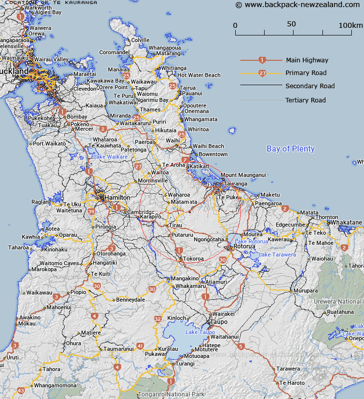
Map showing location of Te Kauranga


LINZ description: For Trig. Station in the Kaimai Range
Latitude: -37.880673
Longitude: 175.936345
Northing: 5803359.1
Easting: 1858248.5
Land District: South Auckland
Feat Type: Trig Station


Scroll down to see a more detailed road map and below that a topographical map showing the location of Te Kauranga. The road map has been supplied by openstreetmap and the topographical map of Te Kauranga has been supplied by Land Information New Zealand (LINZ).

Yes you can use the top static map for you school/university project or personal website with a link back. Contact me for any commercial use.

Te Kauranga Map New Zealand


New Zealand places in our database
[ A ] [ B ] [ C ] [ D ] [ E ] [ F ] [ G ] [ H ] [ I ] [ J ] [ K ] [ L ] [ M ] [ N ] [ O ] [ P ] [ Q ] [ R ] [ S ] [ T ] [ U ] [ V ] [ W ] [ X ] [ Y ] [ Z ]


Closest 20 Trig Stations to Te Kauranga

New Mangawhero ( 13.72km )   Langmuir ( 13.72km )   Puketuaroa ( 14.12km )   Puketurua ( 14.12km )   Tiekerero ( 36.79km )   Tiekerereao ( 36.79km )   Pakotare ( 40.06km )   Pakotore ( 40.06km )   Ngakuriawharei ( 50.03km )   Ngakuriawhare ( 50.03km )   Poutakataka ( 52.31km )   Ngakuru ( 52.31km )   Te Pari ( 54.52km )   Te Pareoterawahirua ( 54.52km )   Te Pare ( 54.52km )   Pukeahua ( 61.65km )   Tihiroa ( 71.29km )   Tiheroa ( 71.29km )   Maraonui ( 71.34km )   Maroanui ( 71.34km )   Taupiri ( 72.91km )   Wharekauanga ( 74.19km )   Wharekaunga ( 74.19km )   Tutaengarahi ( 74.69km )   Tutaengarahu ( 74.69km )   Mauiui ( 76.17km )   Oiraraorao ( 78.88km )   Taumatamiere ( 88.14km )   Taumatamiri ( 88.14km )   Pauanui ( 94.09km )   Tairua ( 94.09km )   Kioronui ( 95.89km )   Kiorenui ( 95.89km )   Pouraika ( 96.35km )   Ligars ( 96.35km )   Parikawau ( 96.61km )   Tawhiuau ( 99.08km )   Tawhiwhau ( 99.08km )   Te Whauotemarama ( 101.6km )   Patawa ( 107.12km )