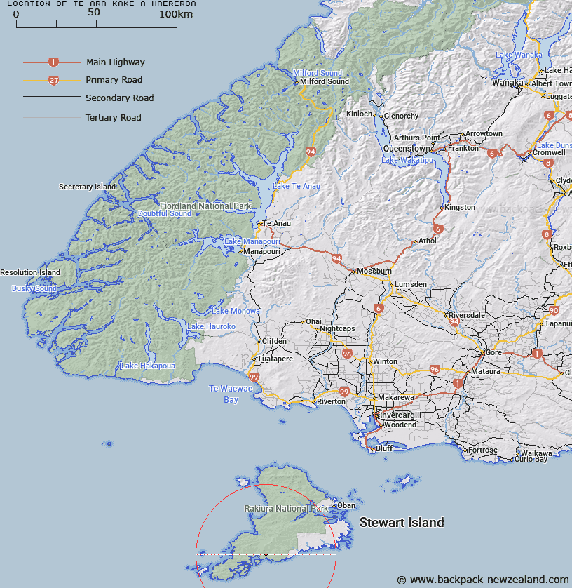
Map showing location of Te Ara Kake a Haereroa


LINZ description: Ridge south end of Tin Range, Stewart Island.
Latitude: -47.154538
Longitude: 167.75449
Northing: 4764300
Easting: 1202400.1
Land District: Southland
Feat Type: Ridge


Scroll down to see a more detailed road map and below that a topographical map showing the location of Te Ara Kake a Haereroa. The road map has been supplied by openstreetmap and the topographical map of Te Ara Kake a Haereroa has been supplied by Land Information New Zealand (LINZ).

Yes you can use the top static map for you school/university project or personal website with a link back. Contact me for any commercial use.

Te Ara Kake a Haereroa Map New Zealand


New Zealand places in our database
[ A ] [ B ] [ C ] [ D ] [ E ] [ F ] [ G ] [ H ] [ I ] [ J ] [ K ] [ L ] [ M ] [ N ] [ O ] [ P ] [ Q ] [ R ] [ S ] [ T ] [ U ] [ V ] [ W ] [ X ] [ Y ] [ Z ]


Closest 20 Ridges to Te Ara Kake a Haereroa

Thomson Ridge ( 36.72km )   Anchor Ridge ( 76.34km )   Hump Ridge ( 118.14km )   Table Ridge ( 133.1km )   Sharpridge ( 133.25km )   Heale Ridge ( 135.78km )   Scrubby Spur ( 146.37km )   Heartbreak Spur ( 149.14km )   Centre Spur ( 154.35km )   Gillies Spur ( 155.17km )   Three Stones ( 158.7km )   Cheviot Hills ( 168.8km )   The Ramparts ( 188.45km )   The Falkans Faces ( 192.66km )   Archies Spur ( 193.53km )   Sandy Spur ( 196.21km )   Daw Spur ( 197.5km )   Long Spur ( 199.65km )   Station Ridge ( 200.51km )   Short Spur ( 203.86km )   Ewe Ridge ( 204km )   Wether Ridge ( 204.23km )   Razorback ( 206.94km )   Backbone Ridge ( 208.87km )   Iron Spur ( 209.33km )   Five Fingers Ridge ( 212.45km )   Ross Spur ( 215.03km )   Rocky Ridge ( 217.46km )   Way Spur ( 217.65km )   Centre Spur ( 218.3km )   Dagg Ridge ( 218.84km )   Disputed Spur ( 222.65km )   Master Ridge ( 227.61km )   Commissioners Spur ( 231.36km )   Flat Top Hill ( 235.78km )   Bare Spur ( 236.66km )   Black Spur ( 236.78km )   Gorge Spur ( 237.65km )   Garden Spur ( 237.71km )   Ripper Ridge ( 237.74km )