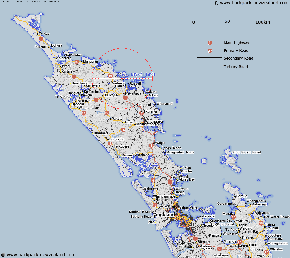
Map showing location of Tareha Point


LINZ description: The point separating Te Puna Inlet and Kerikeri Inlet in the Bay of Islands.
Latitude: -35.193448
Longitude: 174.049011
Northing: 6105000
Easting: 1695500
Land District: North Auckland
Feat Type: Point


Scroll down to see a more detailed road map and below that a topographical map showing the location of Tareha Point. The road map has been supplied by openstreetmap and the topographical map of Tareha Point has been supplied by Land Information New Zealand (LINZ).

Yes you can use the top static map for you school/university project or personal website with a link back. Contact me for any commercial use.

Tareha Point Map New Zealand


New Zealand places in our database
[ A ] [ B ] [ C ] [ D ] [ E ] [ F ] [ G ] [ H ] [ I ] [ J ] [ K ] [ L ] [ M ] [ N ] [ O ] [ P ] [ Q ] [ R ] [ S ] [ T ] [ U ] [ V ] [ W ] [ X ] [ Y ] [ Z ]


Closest 20 Points to Tareha Point

Poraenui Point ( 1.76km )   Day Point ( 2.86km )   Kauri Point ( 3.11km )   Purerua Point ( 4.88km )   Whakapu Point ( 5.63km )   Howe Point ( 6.9km )   Cape Wiwiki ( 7.97km )   Kowhatuhuri Point ( 8.37km )   Tapeka Point ( 8.45km )   Rocky Point ( 9.11km )   Kororareka Point ( 9.26km )   Ti Point ( 9.28km )   Haumai Point ( 11.94km )   Okiato Point ( 13.67km )   Tarawatangata Point ( 13.77km )   Tarawhatangata Point ( 13.77km )   Pupuha Point ( 13.86km )   Kohuwhera Point ( 14km )   Kahuwhera Point ( 14km )   Whangaiwahine Point ( 14.06km )   Tapu Point ( 14.44km )   Tokatokahau Point ( 14.66km )   Mosquito Point ( 14.66km )   Waimangaroa Point ( 14.74km )   Tangitu Point ( 14.89km )   Te Akeake Point ( 15.16km )   Whangapau Point ( 16.1km )   Te Hoanga Point ( 16.63km )   Kapurarahurahu Point ( 17.08km )   Wairiki Point ( 18.03km )   Te Hue Point ( 18.07km )   Okuia Point ( 18.16km )   Whau Point ( 18.51km )   Orerewai Point ( 18.73km )   Rawhiti Point ( 19.07km )   Kohangaatara Point ( 19.75km )   Kariparipa Point ( 22.18km )   Otaneroa Point ( 23.7km )   Karaka Point ( 23.75km )   Marawhiti Point ( 24.49km )