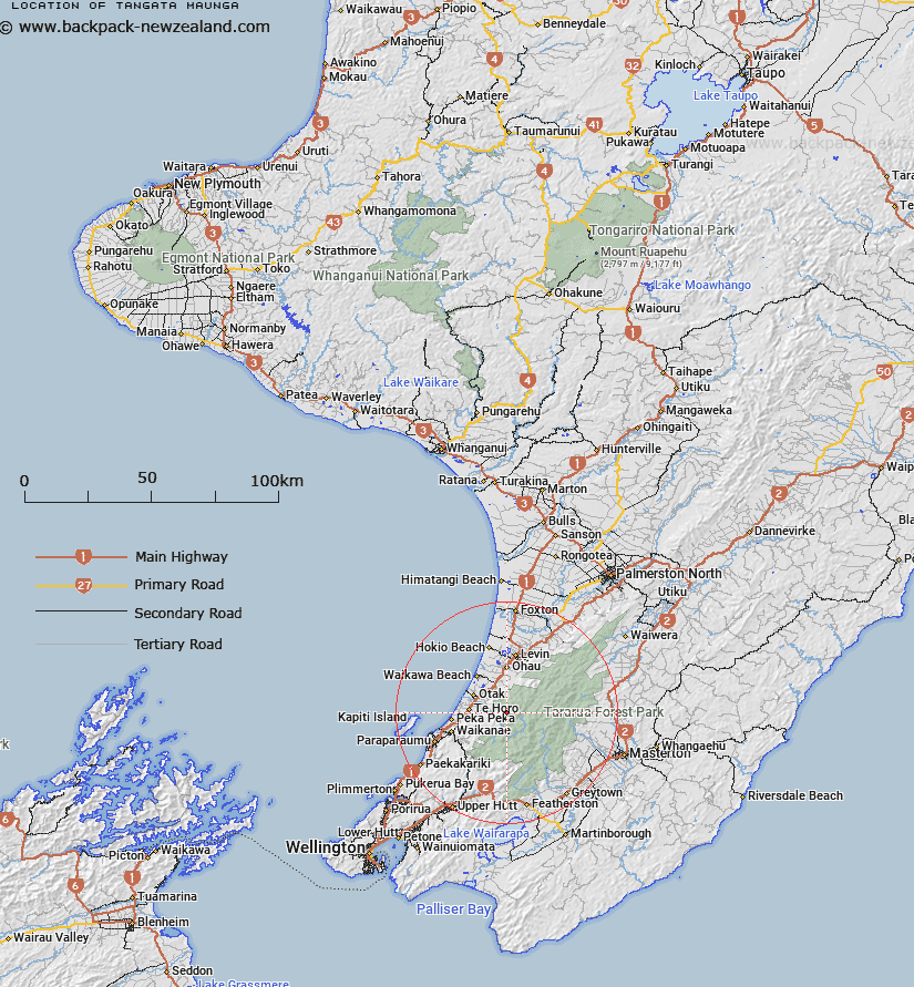
Map showing location of Tangata Maunga


LINZ description: Peak in Tararua State Forest Park, presently identified as Taungata
Latitude: -40.811742
Longitude: 175.255914
Northing: 5479692.2
Easting: 1790271.9
Land District: Wellington
Feat Type: Hill


Scroll down to see a more detailed road map and below that a topographical map showing the location of Tangata Maunga. The road map has been supplied by openstreetmap and the topographical map of Tangata Maunga has been supplied by Land Information New Zealand (LINZ).

Yes you can use the top static map for you school/university project or personal website with a link back. Contact me for any commercial use.

Tangata Maunga Map New Zealand


New Zealand places in our database
[ A ] [ B ] [ C ] [ D ] [ E ] [ F ] [ G ] [ H ] [ I ] [ J ] [ K ] [ L ] [ M ] [ N ] [ O ] [ P ] [ Q ] [ R ] [ S ] [ T ] [ U ] [ V ] [ W ] [ X ] [ Y ] [ Z ]


Closest 20 Hills to Tangata Maunga

Mick ( 2.07km )   Plateau ( 4.58km )   Ringawhati ( 5.03km )   Thompson ( 5.47km )   Waitatapia ( 6.91km )   Shoulder Knob ( 7.43km )   Waitewaewae ( 7.46km )   Tent ( 7.7km )   Junction Knob ( 8.42km )   Mount Crawford ( 8.6km )   Notoriwa ( 8.69km )   Oriwa ( 10.12km )   Nichols ( 10.19km )   Tirotiro Knob ( 10.2km )   Kahiwiroa ( 10.55km )   Kelleher ( 10.6km )   Table Top ( 11.09km )   Puketoro ( 11.33km )   Panatewaewae ( 11.4km )   Aokaparangi ( 11.9km )   Dracophyllum Knob ( 11.99km )   Simpson ( 12.02km )   Pukeatua ( 12.06km )   Wright ( 12.31km )   Waiopehu ( 12.39km )   Twin Peak ( 12.42km )   Shingle Slip Knob ( 12.55km )   Dennan ( 12.59km )   Spion Kop ( 12.77km )   Spion Kop Peak ( 12.94km )   Tuiti ( 13.06km )   Mclntosh ( 13.07km )   Tunui ( 13.08km )   Maungahuka ( 13.18km )   Vosseler ( 13.37km )   Yeates ( 13.46km )   Richards Knob ( 13.58km )   Boyd-Wilson Knob ( 13.65km )   Angle Knob ( 13.91km )   Bridge Peak ( 13.92km )