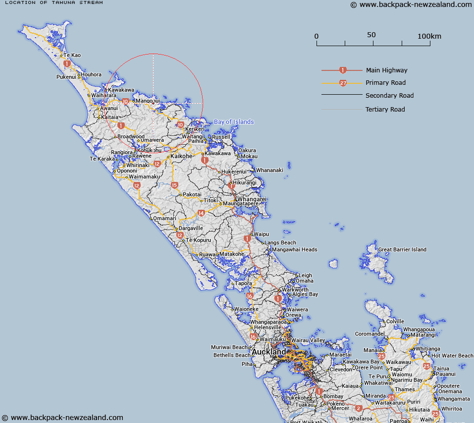
Map showing location of Tahuna Stream


LINZ description: Feature shown on: NZMS260 P04 Q04 Edition 1 1984
Latitude: -35.006222
Longitude: 173.685722
Northing: 6126052.1
Easting: 1662569.1
Land District: North Auckland
Feat Type: Stream


Scroll down to see a more detailed road map and below that a topographical map showing the location of Tahuna Stream. The road map has been supplied by openstreetmap and the topographical map of Tahuna Stream has been supplied by Land Information New Zealand (LINZ).

Yes you can use the top static map for you school/university project or personal website with a link back. Contact me for any commercial use.
Tahuna Stream Map New Zealand


New Zealand places in our database
[ A ] [ B ] [ C ] [ D ] [ E ] [ F ] [ G ] [ H ] [ I ] [ J ] [ K ] [ L ] [ M ] [ N ] [ O ] [ P ] [ Q ] [ R ] [ S ] [ T ] [ U ] [ V ] [ W ] [ X ] [ Y ] [ Z ]


Closest 20 Streams to Tahuna Stream

Otui Creek ( 2.14km )   Otuhi Creek ( 2.14km )   Taupo Creek ( 2.51km )   Sherman Stream ( 3.07km )   Mangataraire Stream ( 3.25km )   Camp Creek ( 3.61km )   Wainiwha Creek ( 3.89km )   Waipukakahau Stream ( 4.08km )   Tupou Stream ( 4.44km )   Unuhia Stream ( 4.52km )   Waihi Creek ( 4.82km )   Waipapa Stream ( 4.92km )   Kahoe Stream ( 4.96km )   Ngaiaroa Stream ( 5.65km )   Ngaraumaunu Stream ( 5.66km )   Waik?hatu Stream ( 5.69km )   Stony Stream ( 5.69km )   Iwitaua Stream ( 5.89km )   Otangi Stream ( 7.25km )   Okokiri Stream ( 7.8km )   Waiwhau Stream ( 8.25km )   Maungaroa Stream ( 8.37km )   Mangahoutoa Stream ( 8.47km )   Popoti Stream ( 8.82km )   Waihapa Stream ( 8.92km )   Waiatua Stream ( 9.02km )   Waimahana Stream ( 9.44km )   Waitapu Creek ( 9.53km )   Tauranga Stream ( 9.53km )   Mangawhero Stream ( 9.74km )   Hihi Stream ( 9.81km )   Waipahihi Creek ( 9.88km )   Taurangaiti Stream ( 9.99km )   Maunoaroa Stream ( 10.07km )   Mangaroa Stream ( 10.07km )   Orua Stream ( 10.38km )   Kairawaru Stream ( 10.75km )   Kaeo River ( 10.88km )   Komutu Creek ( 10.95km )   Tuhoatea Stream ( 11.28km )