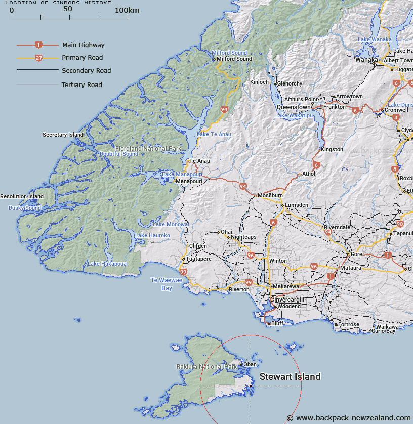
Map showing location of Sinbads Mistake


LINZ description: Bay 1.6km South of Pikaro Bay, and 1.5km North of Stirling Head, Stewart Island. Lords River Survey District.
Latitude: -47.051675
Longitude: 168.199215
Northing: 4777900
Easting: 1235400
Land District: Southland
Feat Type: Bay


Scroll down to see a more detailed road map and below that a topographical map showing the location of Sinbads Mistake. The road map has been supplied by openstreetmap and the topographical map of Sinbads Mistake has been supplied by Land Information New Zealand (LINZ).

Yes you can use the top static map for you school/university project or personal website with a link back. Contact me for any commercial use.

Sinbads Mistake Map New Zealand


New Zealand places in our database
[ A ] [ B ] [ C ] [ D ] [ E ] [ F ] [ G ] [ H ] [ I ] [ J ] [ K ] [ L ] [ M ] [ N ] [ O ] [ P ] [ Q ] [ R ] [ S ] [ T ] [ U ] [ V ] [ W ] [ X ] [ Y ] [ Z ]


Closest 20 Bays to Sinbads Mistake

Pikaroro Bay ( 1.71km )   North Arm ( 1.73km )   Port Adventure ( 2.06km )   Abrahams Bosom ( 2.59km )   Oyster Bay ( 3.68km )   Chew Tobacco Bay ( 4.73km )   Tikotatahi Bay ( 5.51km )   Lauras Leg ( 6.45km )   Little Kuri Bay ( 7.12km )   Cooey Bay ( 7.99km )   Lee Cove ( 8.01km )   Surveyors Bay ( 8.95km )   Deep Bay ( 9.07km )   Goose Cove ( 9.36km )   Glory Cove ( 9.4km )   Sailors Rest ( 9.86km )   Big Glory Bay ( 10.08km )   Misery Bay ( 11.3km )   Tutaepawhati Bay ( 12.08km )   Gentian Cove ( 12.11km )   Eastern Bay ( 12.15km )   Jacky Lee Bay ( 12.33km )   Carter Bay ( 12.9km )   Papatiki Bay ( 12.9km )   Manning Bay ( 13.21km )   Roger Bay ( 13.4km )   The Snuggery ( 13.65km )   Kuri Bay ( 13.76km )   Big Kuri Bay ( 13.76km )   Coupar Bay ( 13.79km )   Cooper Bay ( 13.79km )   Back Bay ( 13.95km )   Karimoni Beach ( 13.95km )   Joss Bay ( 14.08km )   Hapuatuna Bay ( 14.37km )   Sydney Cove ( 14.46km )   Buller Bay ( 14.55km )   Pinch Gut ( 15.21km )   Traills Bay ( 16.32km )   Deep Bay ( 16.7km )