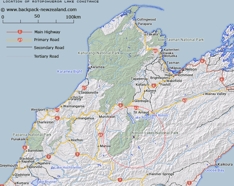
Map showing location of Rotopōhueroa / Lake Constance
LINZ description: A lake below Franklin Ridge in Spenser Mountains approximately 26km southwest of Lake Rotoiti. Feature shown on: NZMS260 M30 Edition 1 1989; NZTopo50-BS24 720417
Latitude: -42.076056
Longitude: 172.6615
Northing: 5341723.9
Easting: 1571999.6
Land District: Nelson
Feat Type: Lake
Latitude: -42.076056
Longitude: 172.6615
Northing: 5341723.9
Easting: 1571999.6
Land District: Nelson
Feat Type: Lake

Scroll down to see a more detailed road map and below that a topographical map showing the location of Rotopōhueroa / Lake Constance. The road map has been supplied by openstreetmap and the topographical map of Rotopōhueroa / Lake Constance has been supplied by Land Information New Zealand (LINZ).
Yes you can use the top static map for you school/university project or personal website with a link back. Contact me for any commercial use.
[ A ] [ B ] [ C ] [ D ] [ E ] [ F ] [ G ] [ H ] [ I ] [ J ] [ K ] [ L ] [ M ] [ N ] [ O ] [ P ] [ Q ] [ R ] [ S ] [ T ] [ U ] [ V ] [ W ] [ X ] [ Y ] [ Z ]