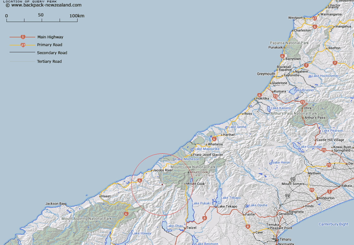
Map showing location of Query Peak


LINZ description: A peak on the northwest side of Zora Glacier, Bannock Brae Range, Southern Alps / Kā Tiritiri o te Moana. Spot height 2259m. NZTopo50-BY14 435522.
Latitude: -43.738955
Longitude: 169.814448
Northing: 5152187.4
Easting: 1343478.1
Land District: Westland
Feat Type: Hill


Scroll down to see a more detailed road map and below that a topographical map showing the location of Query Peak. The road map has been supplied by openstreetmap and the topographical map of Query Peak has been supplied by Land Information New Zealand (LINZ).

Yes you can use the top static map for you school/university project or personal website with a link back. Contact me for any commercial use.

Query Peak Map New Zealand


New Zealand places in our database
[ A ] [ B ] [ C ] [ D ] [ E ] [ F ] [ G ] [ H ] [ I ] [ J ] [ K ] [ L ] [ M ] [ N ] [ O ] [ P ] [ Q ] [ R ] [ S ] [ T ] [ U ] [ V ] [ W ] [ X ] [ Y ] [ Z ]


Closest 20 Hills to Query Peak

Mount Doubtful ( 0.52km )   Crystal Peak ( 1.05km )   Jagged Spur ( 3.54km )   Tekoe ( 4.51km )   Fettes Peak ( 4.64km )   White Hummock ( 4.68km )   Mount Strachan ( 4.69km )   Mount Butzbach ( 5.13km )   Mount Glower ( 5.57km )   McGloin Peak ( 6.01km )   Mount Elliot ( 6.19km )   Mount Eliott ( 6.19km )   Whitcombe Peak ( 6.41km )   Mount Morse ( 6.65km )   The Clue ( 7.44km )   MacKnob ( 7.87km )   Mount Dechen ( 8km )   Mount Mirk ( 8.16km )   Notable Peak ( 8.26km )   Mount Peculiar ( 8.33km )   Conical Hill ( 8.71km )   The Helmet ( 8.77km )   Mount Townsend ( 8.97km )   Mathers Peak ( 9.33km )   Mount Hawkins ( 9.36km )   Mount Matheson ( 9.77km )   The Pommel ( 10.16km )   Mount McDonald ( 10.2km )   Mount Hermann ( 10.42km )   Cassel Hill ( 10.6km )   Mount Humphries ( 10.72km )   Mount Howitt ( 10.84km )   Mount Gorden ( 11.13km )   Mount Gordon ( 11.13km )   Mount Baker ( 11.23km )   Mount Nihokohatu ( 11.23km )   Kerr Peaks ( 11.26km )   Mount Percy Smith ( 11.29km )   Mount Kinihi ( 11.34km )   Mount Ritchie ( 11.52km )