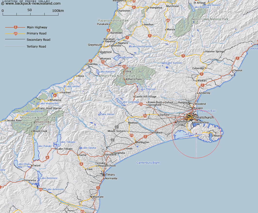
Map showing location of Prices Valley


LINZ description: Valley to west of Lake Forsyth
Latitude: -43.772075
Longitude: 172.706761
Northing: 5153400
Easting: 1576400
Land District: Canterbury
Feat Type: Valley


Scroll down to see a more detailed road map and below that a topographical map showing the location of Prices Valley. The road map has been supplied by openstreetmap and the topographical map of Prices Valley has been supplied by Land Information New Zealand (LINZ).

Yes you can use the top static map for you school/university project or personal website with a link back. Contact me for any commercial use.

Prices Valley Map New Zealand


New Zealand places in our database
[ A ] [ B ] [ C ] [ D ] [ E ] [ F ] [ G ] [ H ] [ I ] [ J ] [ K ] [ L ] [ M ] [ N ] [ O ] [ P ] [ Q ] [ R ] [ S ] [ T ] [ U ] [ V ] [ W ] [ X ] [ Y ] [ Z ]


Closest 20 Valleys to Prices Valley

McQueens Valley ( 8.25km )   Church Gully ( 14.49km )   Starvation Gully ( 19.42km )   Rocky Gully ( 22.16km )   Nikau Palm Gully ( 22.67km )   Wooded Gully ( 69.86km )   Oyster Gully ( 70.37km )   Surveyors Gully ( 71.7km )   Knowles Gully ( 71.82km )   Surveyors Gully ( 72.27km )   Jones Gully ( 73.06km )   Bishops Gully ( 76.6km )   Cleathings Valley ( 77.54km )   Boil Gully ( 80.81km )   Ohuriawa Gorge ( 80.9km )   Smothering Gully ( 81.94km )   Bishops Gully ( 81.96km )   Otarama Gorge ( 83.93km )   Reservoir Gully ( 85.59km )   Camping Gully ( 88.59km )   Staircase Gully ( 89.06km )   Happy Valley ( 91.24km )   Tent Gully ( 91.64km )   Rakaia Gorge ( 92.31km )   Carrington Gorge ( 92.48km )   Pipe Clay Gully ( 94.43km )   Deer Wallow Gully ( 94.74km )   Black Hole ( 95.25km )   Langs Gully ( 95.63km )   Gum Tree Gully ( 96.89km )   Seagull Gully ( 97.12km )   Pig Gully ( 97.65km )   Soda Gully ( 99.71km )   Hurricane Gully ( 102.08km )   Haircut Gully ( 102.66km )   Terrible Gully ( 102.77km )   Craigieburn Cutting ( 104.42km )   Petrifying Gully ( 107.27km )   Boundary Gully ( 108.33km )   Cascade Glen ( 109.41km )