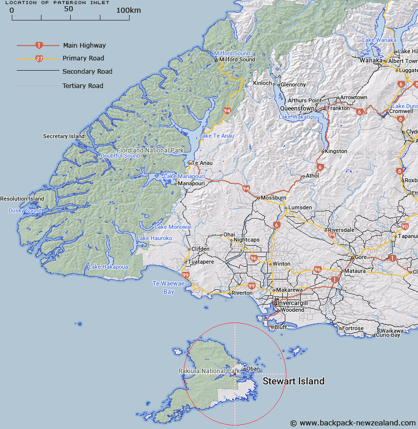
Map showing location of Paterson Inlet


LINZ description: Feature shown on: NZMS260-E48 330527; NZTopo50-CJ09 240903;
Latitude: -46.933257
Longitude: 168.060683
Northing: 4790399.9
Easting: 1224049.5
Land District: Southland
Feat Type: Bay


Scroll down to see a more detailed road map and below that a topographical map showing the location of Paterson Inlet. The road map has been supplied by openstreetmap and the topographical map of Paterson Inlet has been supplied by Land Information New Zealand (LINZ).

Yes you can use the top static map for you school/university project or personal website with a link back. Contact me for any commercial use.

Paterson Inlet Map New Zealand


New Zealand places in our database
[ A ] [ B ] [ C ] [ D ] [ E ] [ F ] [ G ] [ H ] [ I ] [ J ] [ K ] [ L ] [ M ] [ N ] [ O ] [ P ] [ Q ] [ R ] [ S ] [ T ] [ U ] [ V ] [ W ] [ X ] [ Y ] [ Z ]


Closest 20 Bays to Paterson Inlet

Dundas Harbour ( 1.8km )   Prices Inlet ( 2.49km )   Surveyors Bay ( 2.54km )   Whalers Base ( 2.54km )   Hapuatuna Bay ( 2.54km )   Abrahams Bay ( 2.68km )   Linklater Bay ( 2.74km )   Little Kaipipi Bay ( 2.83km )   Dodgers Bay ( 2.98km )   Kaipipi Bay ( 3.05km )   Kidney Fern Arm ( 3.1km )   Fuschia Bay ( 3.32km )   Sawdust Bay ( 4.64km )   Avelavo Bay ( 4.95km )   Vaila Voe Bay ( 4.95km )   Jack The Rippers Bay ( 4.95km )   Thule Bay ( 5.29km )   Gentian Cove ( 5.33km )   Golden Bay ( 5.72km )   Sydney Cove ( 5.8km )   The Snuggery ( 6km )   Deep Bay ( 6.08km )   Thomson Bay ( 6.6km )   Traills Bay ( 6.61km )   Roger Bay ( 6.66km )   Kaiporohu Bay ( 6.71km )   Big Glory Bay ( 6.81km )   North Arm ( 7.02km )   Little Bay ( 7.29km )   Leask Bay ( 7.48km )   Evening Cove ( 7.56km )   Pinch Gut ( 7.58km )   Bragg Bay ( 7.65km )   Sailors Rest ( 7.68km )   Whale Corner ( 7.72km )   Jensen Bay ( 7.88km )   Sarah Cove ( 7.89km )   Torias Corner ( 7.91km )   Harrold Bay ( 8.22km )   Carter Bay ( 8.29km )