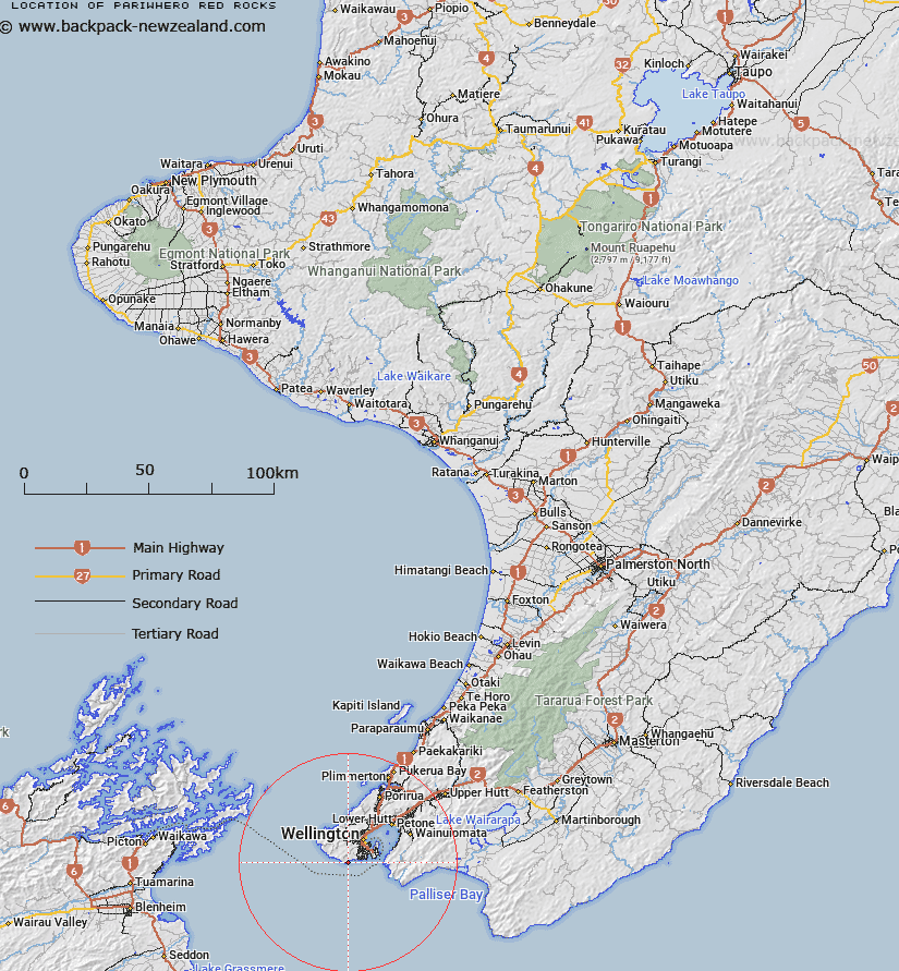
Map showing location of Pariwhero/Red Rocks


LINZ description: Located along the south coast, west of Wellington, topographic map 260-R27,R28&Pt.Q27-Wellington, GR 543 817. Extent includes rocks on the foreshore and submerged along the coastal margin.
Latitude: -41.358582
Longitude: 174.725133
Northing: 5420000
Easting: 1744300
Land District: Wellington
Feat Type: Rock


Scroll down to see a more detailed road map and below that a topographical map showing the location of Pariwhero/Red Rocks. The road map has been supplied by openstreetmap and the topographical map of Pariwhero/Red Rocks has been supplied by Land Information New Zealand (LINZ).

Yes you can use the top static map for you school/university project or personal website with a link back. Contact me for any commercial use.

Pariwhero/Red Rocks Map New Zealand


New Zealand places in our database
[ A ] [ B ] [ C ] [ D ] [ E ] [ F ] [ G ] [ H ] [ I ] [ J ] [ K ] [ L ] [ M ] [ N ] [ O ] [ P ] [ Q ] [ R ] [ S ] [ T ] [ U ] [ V ] [ W ] [ X ] [ Y ] [ Z ]


Closest 20 Rocks to Pariwhero/Red Rocks

The Sirens Rocks ( 2.87km )   Te Raekaihau ( 5.77km )   Gibraltar Rock ( 8.36km )   Steeple Rock/Te Aroaro-o-Kupe ( 10.42km )   Steeple Rock ( 10.42km )   Fishermans Rock ( 21.38km )   Te Korohiwa Rocks ( 28.57km )   Toka-a-Papa Reef ( 32.59km )   Tokaapapa Reef (Grandfather Rocks) ( 32.59km )   Toka P?taka Rock ( 34.64km )   Raukawa Rock ( 34.76km )   White Rocks ( 43.75km )   Putangirua Pinnacles ( 44.75km )   The Knobbys ( 47.83km )   Tomokoko Rock ( 49.21km )   Te Kawakawa Rocks ( 50.97km )   Te Ope-a-Kupe Rock ( 53.6km )   Ngakuriahinepoupou ( 54.21km )   Cod Rocks ( 56.46km )   Blue Slip ( 60.29km )   White Rock ( 60.63km )   Postmans Rock ( 63.76km )   Glue Pot ( 69.16km )   Chancet Rocks ( 69.29km )   Hapuka Rock ( 81.97km )   Glendhu Rocks ( 84.96km )   Nga Kiore (Jag Rocks) ( 85.73km )   Jag Rocks ( 85.73km )   Archway ( 88.73km )   Waiohine Pinnacles ( 88.74km )   Blue Slip ( 89.54km )   Grey Rock ( 90.16km )   Honeycomb Rock ( 90.67km )   The Beef Barrels (Kahikatoa) ( 91.78km )   Rakariri ( 92.26km )   Brockett Rocks ( 92.49km )   Pakikauokiwi (Black Rock) ( 93.54km )   Lone Rock ( 94.02km )   Chicot Rock ( 94.38km )   Tapuareroutuutu ( 94.38km )