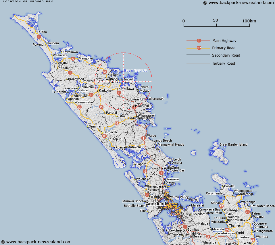
Map showing location of Orongo Bay


LINZ description: Prominent Bay east of Pahia south east of Kororareka Bay.
Latitude: -35.28544
Longitude: 174.145865
Northing: 6094700
Easting: 1704200
Land District: North Auckland
Feat Type: Bay


Scroll down to see a more detailed road map and below that a topographical map showing the location of Orongo Bay. The road map has been supplied by openstreetmap and the topographical map of Orongo Bay has been supplied by Land Information New Zealand (LINZ).

Yes you can use the top static map for you school/university project or personal website with a link back. Contact me for any commercial use.

Orongo Bay Map New Zealand


New Zealand places in our database
[ A ] [ B ] [ C ] [ D ] [ E ] [ F ] [ G ] [ H ] [ I ] [ J ] [ K ] [ L ] [ M ] [ N ] [ O ] [ P ] [ Q ] [ R ] [ S ] [ T ] [ U ] [ V ] [ W ] [ X ] [ Y ] [ Z ]


Closest 20 Bays to Orongo Bay

Uruti Bay ( 1.22km )   Te Wahapu Inlet ( 2.18km )   Pomare Bay ( 2.39km )   Opito Bay ( 2.46km )   Paroa Bay ( 2.56km )   Matauwhi Bay ( 2.64km )   Waikare Inlet ( 2.92km )   Pipiroa Bay ( 2.92km )   Oneroa Bay ( 3.2km )   Onerua Bay ( 3.2km )   Waitata Bay ( 3.55km )   Tahapuke Bay ( 3.65km )   English Bay ( 3.88km )   Kororareka Bay ( 3.97km )   Te Angamate Bay ( 4.87km )   Waihihi Bay ( 5.01km )   Clendon Cove ( 5.17km )   Manawaora Bay ( 5.21km )   Manawara Bay ( 5.21km )   Cooks Cove ( 5.34km )   Te Ti Bay ( 5.72km )   Orokawa Bay ( 5.8km )   Jacks Bay ( 5.83km )   Assassination Cove ( 5.87km )   Te Hue Bay ( 6.02km )   Dicks Bay ( 6.12km )   Opunga Cove ( 6.48km )   Te Rawhiti Inlet ( 6.51km )   Putakokota Bay ( 6.55km )   Te Huruhi Bay ( 6.73km )   Waiti Bay ( 6.99km )   Wairaka Bay ( 7.05km )   Waipohutukawa Bay ( 7.34km )   Wairoa Bay ( 7.37km )   Waipao Bay ( 7.42km )   Mangahawea Bay ( 7.84km )   Waipiro Bay ( 7.84km )   Hahangarua Bay ( 7.85km )   Pareanui Bay ( 8.11km )   Awaawaroa Bay ( 8.19km )