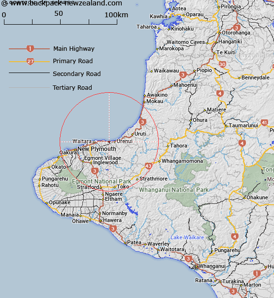
Map showing location of Onaero
LINZ description: Locality on the main highway, 3km West of Urenui and 5km East of Motunui. Waitara Survey District.
Latitude: -38.99787
Longitude: 174.34824
Northing: 5682595.3
Easting: 1716752.2
Land District: Taranaki
Feat Type: Locality
Latitude: -38.99787
Longitude: 174.34824
Northing: 5682595.3
Easting: 1716752.2
Land District: Taranaki
Feat Type: Locality

Scroll down to see a more detailed road map and below that a topographical map showing the location of Onaero. The road map has been supplied by openstreetmap and the topographical map of Onaero has been supplied by Land Information New Zealand (LINZ).
Yes you can use the top static map for you school/university project or personal website with a link back. Contact me for any commercial use.
[ A ] [ B ] [ C ] [ D ] [ E ] [ F ] [ G ] [ H ] [ I ] [ J ] [ K ] [ L ] [ M ] [ N ] [ O ] [ P ] [ Q ] [ R ] [ S ] [ T ] [ U ] [ V ] [ W ] [ X ] [ Y ] [ Z ]