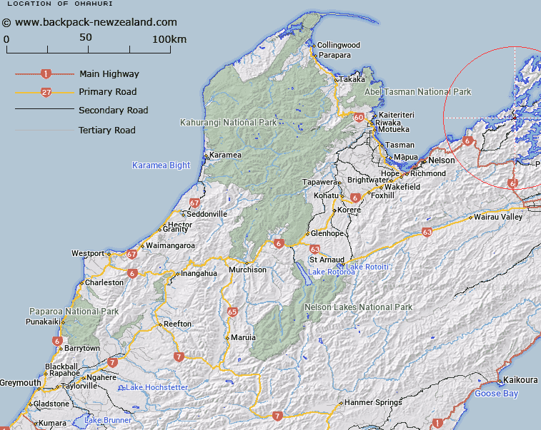
Map showing location of Ōmāhuri
LINZ description: A ridge approximately 1 km wide aligned southwest-northeast, separating Whakitenga Bay in Squally Cove and Elaine Bay in Tennyson Inlet, Marlborough Sounds. NZTopo50-BP28 641554.
Latitude: -41.049529
Longitude: 173.764201
Northing: 5455463.4
Easting: 1664222.6
Land District: Nelson
Feat Type: Isthmus
Latitude: -41.049529
Longitude: 173.764201
Northing: 5455463.4
Easting: 1664222.6
Land District: Nelson
Feat Type: Isthmus

Scroll down to see a more detailed road map and below that a topographical map showing the location of Ōmāhuri. The road map has been supplied by openstreetmap and the topographical map of Ōmāhuri has been supplied by Land Information New Zealand (LINZ).
Yes you can use the top static map for you school/university project or personal website with a link back. Contact me for any commercial use.
[ A ] [ B ] [ C ] [ D ] [ E ] [ F ] [ G ] [ H ] [ I ] [ J ] [ K ] [ L ] [ M ] [ N ] [ O ] [ P ] [ Q ] [ R ] [ S ] [ T ] [ U ] [ V ] [ W ] [ X ] [ Y ] [ Z ]