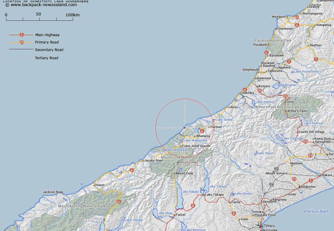
Map showing location of Ōkāritoiti / Lake Windermere


LINZ description: Small lake north of Ōkārito Lagoon.
Latitude: -43.154025
Longitude: 170.232565
Northing: 5218362.6
Easting: 1374989.4
Land District: Westland
Feat Type: Lake


Scroll down to see a more detailed road map and below that a topographical map showing the location of Ōkāritoiti / Lake Windermere. The road map has been supplied by openstreetmap and the topographical map of Ōkāritoiti / Lake Windermere has been supplied by Land Information New Zealand (LINZ).

Yes you can use the top static map for you school/university project or personal website with a link back. Contact me for any commercial use.
Ōkāritoiti / Lake Windermere Map New Zealand


New Zealand places in our database
[ A ] [ B ] [ C ] [ D ] [ E ] [ F ] [ G ] [ H ] [ I ] [ J ] [ K ] [ L ] [ M ] [ N ] [ O ] [ P ] [ Q ] [ R ] [ S ] [ T ] [ U ] [ V ] [ W ] [ X ] [ Y ] [ Z ]


Closest 20 Lakes to Ōkāritoiti / Lake Windermere

Aorangi Lagoon ( 3.73km )   ?k?rito Lagoon ( 4.32km )   Okarito Lagoon ( 4.32km )   Lake Wahapo ( 10.95km )   Saltwater Lagoon ( 11.77km )   Three Mile Lagoon ( 12.67km )   Lake Joan ( 13.37km )   Lake Darby ( 13.67km )   Lake Miro ( 13.7km )   Lake Rotokino ( 15.99km )   Hikimutu Lagoon ( 16km )   Alpine Lake/Ata Puai ( 16.73km )   Alpine Lake ( 16.73km )   White Heron Lagoon ( 16.93km )   Five Mile Lagoon ( 17.74km )   Lake Mapourika ( 18.18km )   Lake Pratt ( 22.54km )   Lake Wombat ( 28.21km )   Peters Pool ( 29.96km )   Lake Ianthe/Matahi ( 33.57km )   Lake Ianthe ( 33.57km )   Lake Mueller ( 33.74km )   Lake Gibbs ( 33.74km )   Lake Gibb ( 33.74km )   Ice Lake ( 34.52km )   Lake Gault ( 36.65km )   Lake Lyttle ( 37.05km )   Lake Barrowman ( 37.53km )   Lake Matheson ( 38.36km )   Abel Lake ( 38.78km )   Ounatai Lagoon ( 39.31km )   Saddle Lake ( 46.93km )   Reid Lake ( 54.22km )   Ivory Lake ( 55.36km )   Balance Lake ( 55.36km )   Hooker Lake ( 59.78km )   Blue Lakes ( 60.29km )   Tasman Lake ( 60.88km )   Zalas Pond ( 61.8km )   Teal Tarn ( 62.22km )