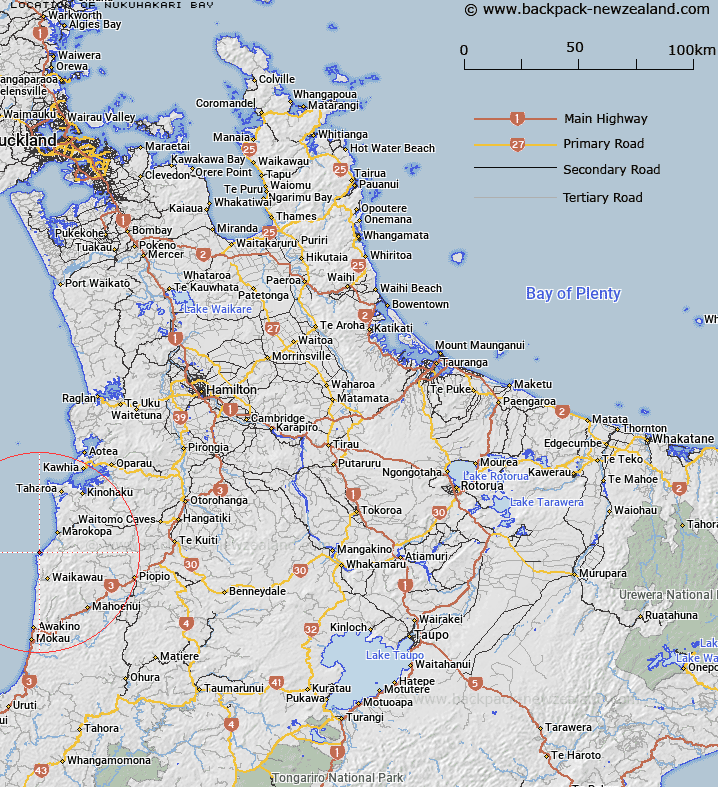
Map showing location of Nukuhakari Bay


LINZ description: Bay on the west coast between Kaiwhia Harbour and Mokau, east of Te Kuiti.
Latitude: -38.374881
Longitude: 174.650805
Northing: 5751300
Easting: 1744200
Land District: South Auckland
Feat Type: Bay


Scroll down to see a more detailed road map and below that a topographical map showing the location of Nukuhakari Bay. The road map has been supplied by openstreetmap and the topographical map of Nukuhakari Bay has been supplied by Land Information New Zealand (LINZ).

Yes you can use the top static map for you school/university project or personal website with a link back. Contact me for any commercial use.

Nukuhakari Bay Map New Zealand


New Zealand places in our database
[ A ] [ B ] [ C ] [ D ] [ E ] [ F ] [ G ] [ H ] [ I ] [ J ] [ K ] [ L ] [ M ] [ N ] [ O ] [ P ] [ Q ] [ R ] [ S ] [ T ] [ U ] [ V ] [ W ] [ X ] [ Y ] [ Z ]


Closest 20 Bays to Nukuhakari Bay

Ngararahae Bay ( 4.11km )   Arohaki Bay ( 29.01km )   Waikutakuta Inlet ( 29.57km )   Ohineruru Bay ( 30.19km )   Oraka Bay ( 30.68km )   Kawhia Harbour ( 31.1km )   Arapatiki Bay ( 32.29km )   Kaitawa Inlet ( 34.18km )   Te Ariaotewiwini Inlet ( 34.99km )   Rakaunui Inlet ( 35.2km )   Mangakara Bay ( 36.39km )   Te Wharu Bay ( 38.9km )   Mangaora Inlet ( 40.03km )   Potoorangi Bay ( 43.38km )   Matakowhai Bay ( 43.97km )   Koruahamauti Bay ( 44.81km )   Korua Bay ( 44.81km )   Aotea Harbour ( 47.47km )   Schnackenberg Bay ( 47.82km )   Whale Bay ( 62.64km )   Manu Bay ( 63.17km )   Aroaro Bay ( 67.26km )   Lorenzen Bay ( 67.33km )   Cox Bay ( 67.5km )   Okete Bay ( 67.58km )   Whaingaroa Harbour ( 68.09km )   Patikirau Bay ( 68.69km )   Haroto Bay ( 69.25km )   Hauroto Bay ( 69.25km )   Whiwhiroa Bay ( 69.7km )   Waiwhara Bay ( 70.34km )   North Taranaki Bight ( 71.76km )   Flynn Cove ( 92.13km )   Port Taranaki ( 92.48km )   Te Papa Bay ( 102.88km )   Te Awaroa Bay ( 103.31km )   Whanganui Bay ( 104.45km )   Waihora Bay ( 104.65km )   Cherry Bay ( 106.87km )   Western Bay ( 107.09km )