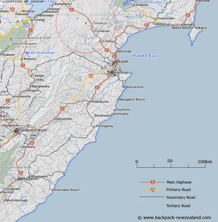
Map showing location of Ninihi


LINZ description: Located near Ahimanawa Range, where Ohane Stream has its source.
Latitude: -39.022359
Longitude: 176.503289
Northing: 5674900
Easting: 1903300
Land District: Hawke's Bay
Feat Type: Locality


Scroll down to see a more detailed road map and below that a topographical map showing the location of Ninihi. The road map has been supplied by openstreetmap and the topographical map of Ninihi has been supplied by Land Information New Zealand (LINZ).

Yes you can use the top static map for you school/university project or personal website with a link back. Contact me for any commercial use.

Ninihi Map New Zealand


New Zealand places in our database
[ A ] [ B ] [ C ] [ D ] [ E ] [ F ] [ G ] [ H ] [ I ] [ J ] [ K ] [ L ] [ M ] [ N ] [ O ] [ P ] [ Q ] [ R ] [ S ] [ T ] [ U ] [ V ] [ W ] [ X ] [ Y ] [ Z ]


Closest 20 Localitys to Ninihi

Tarawera ( 6.09km )   Pohokura ( 6.32km )   Turangakumu ( 13.25km )   Taurangakumu ( 13.25km )   Te Haroto ( 14.17km )   Tanguro ( 14.41km )   Tanguru ( 14.41km )   Whakaterehu ( 14.64km )   Whakatarehu ( 14.64km )   Whakahu ( 14.78km )   Wakahu ( 14.78km )   Hurumauku ( 15.32km )   Huramauku ( 15.32km )   Tangarieke ( 15.89km )   Tangatieke ( 15.89km )   Paraweranui ( 19.72km )   Paraneraui ( 19.72km )   Pangawahine ( 19.73km )   Pungawahene ( 19.73km )   Rangitaiki ( 20.11km )   Tahuwera ( 20.48km )   Tahunera ( 20.48km )   Puketitiri ( 28.98km )   Iwitahi ( 29.22km )   Te Pohue ( 29.79km )   Te Pohui ( 29.79km )   Waimihia ( 30.31km )   Ohurakura ( 30.41km )   Matea ( 31.98km )   Waikoau ( 35.93km )   Patoka ( 36.85km )   Tutira ( 38.61km )   Kahika ( 40.76km )   Kuripapanga ( 44.16km )   Kuripapango ( 44.16km )   Putorino ( 44.93km )   Waitahanui ( 44.94km )   Willowford ( 46.18km )   Hatepe ( 46.41km )   Te Awakautuku ( 46.44km )