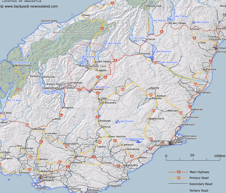
Map showing location of Newcastle


LINZ description: Locality on the Clutha river, 5Km East of Wanaka township. Block XI Lower Wanaka Survey District.
Latitude: -44.682569
Longitude: 169.191735
Northing: 5045253
Easting: 1298195.1
Land District: Otago
Feat Type: Locality


Scroll down to see a more detailed road map and below that a topographical map showing the location of Newcastle. The road map has been supplied by openstreetmap and the topographical map of Newcastle has been supplied by Land Information New Zealand (LINZ).

Yes you can use the top static map for you school/university project or personal website with a link back. Contact me for any commercial use.

Newcastle Map New Zealand


New Zealand places in our database
[ A ] [ B ] [ C ] [ D ] [ E ] [ F ] [ G ] [ H ] [ I ] [ J ] [ K ] [ L ] [ M ] [ N ] [ O ] [ P ] [ Q ] [ R ] [ S ] [ T ] [ U ] [ V ] [ W ] [ X ] [ Y ] [ Z ]


Closest 20 Localitys to Newcastle

Maungawera ( 3.94km )   Mount Barker ( 5.86km )   Lower Hawea Flat ( 7.85km )   Hawea Flat ( 8.37km )   H?wea Flat ( 8.37km )   Lagoon Valley ( 9.53km )   Luggate ( 9.58km )   Lake H?wea ( 9.82km )   Lake Hawea ( 9.82km )   Gladstone ( 13.84km )   Glendhu Bay ( 13.92km )   Queensberry ( 21.02km )   Tarras ( 24.51km )   Lindis Crossing ( 25.36km )   Lindis Valley ( 26.16km )   Cardrona ( 26.53km )   Mount Pisa ( 28.06km )   Ardgour ( 28.37km )   Bendigo ( 29.59km )   Crippletown ( 30.37km )   Minaret Bay ( 31km )   Logantown ( 31.4km )   Macetown ( 35.76km )   Lowburn ( 35.81km )   Cromwell ( 40.18km )   Ripponvale ( 40.36km )   Arrowtown ( 40.64km )   Kawarau Gorge ( 41.77km )   Gibbston ( 42.21km )   Bullendale (The Reefs) ( 42.3km )   Makarora Township ( 42.39km )   Skippers ( 44.03km )   Bannockburn ( 45.3km )   Wharehuanui ( 45.38km )   Waenga ( 45.43km )   Charlestown ( 45.69km )   Matakanui ( 47.53km )   Douglasvale ( 48.24km )   Carricktown ( 48.79km )   Drybread ( 48.8km )