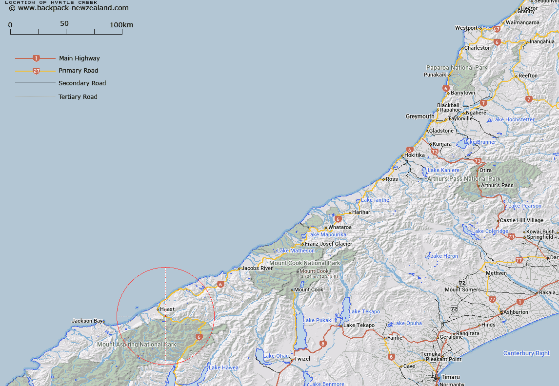
Map showing location of Myrtle Creek


LINZ description: Short left bank tributary of Haast River with outlet South-east of Big Bluff. Blocks XII and XVI Okuru Survey District.
Latitude: -43.930231
Longitude: 169.102095
Northing: 5128486.4
Easting: 1287113.7
Land District: Westland
Feat Type: Stream


Scroll down to see a more detailed road map and below that a topographical map showing the location of Myrtle Creek. The road map has been supplied by openstreetmap and the topographical map of Myrtle Creek has been supplied by Land Information New Zealand (LINZ).

Yes you can use the top static map for you school/university project or personal website with a link back. Contact me for any commercial use.

Myrtle Creek Map New Zealand


New Zealand places in our database
[ A ] [ B ] [ C ] [ D ] [ E ] [ F ] [ G ] [ H ] [ I ] [ J ] [ K ] [ L ] [ M ] [ N ] [ O ] [ P ] [ Q ] [ R ] [ S ] [ T ] [ U ] [ V ] [ W ] [ X ] [ Y ] [ Z ]


Closest 20 Streams to Myrtle Creek

Harris Creek ( 1.15km )   Greenstone Creek ( 1.21km )   Gliding Creek ( 1.89km )   Glitter Burn ( 2.98km )   Snapshot Creek ( 3.23km )   Joes Creek ( 3.97km )   Mica Creek ( 4.08km )   Roy Creek ( 4.38km )   Grassy Creek ( 4.59km )   Staircase Creek ( 4.74km )   Duffer Burn ( 5.03km )   Dismal Creek ( 5.05km )   Stony Creek ( 5.24km )   Trig Creek ( 5.85km )   Gunboat Creek ( 5.89km )   Lather Creek ( 6.19km )   Pile Creek ( 6.43km )   Cron Creek ( 6.64km )   Billy Creek ( 6.67km )   Middle Creek ( 6.69km )   Okuru River ( 6.91km )   Chattering Creek ( 6.95km )   Jamieson Creek ( 7.2km )   Downright Torrent ( 7.37km )   Gus Creek ( 7.45km )   Dancing Creek ( 7.57km )   Retreat Rivulet ( 7.82km )   The Tumbledown ( 8.08km )   Eggeling Creek ( 8.1km )   Slush Creek ( 8.14km )   Bob Creek ( 8.41km )   Omimimi Creek ( 8.45km )   Katie Creek ( 8.62km )   Bayou Creek ( 8.95km )   Warren Creek ( 9.24km )   Swampy Creek ( 9.29km )   Nerger Creek North Branch ( 9.38km )   Cushat Creek ( 9.43km )   Wyllie Creek ( 9.44km )   Crikey Creek ( 9.82km )