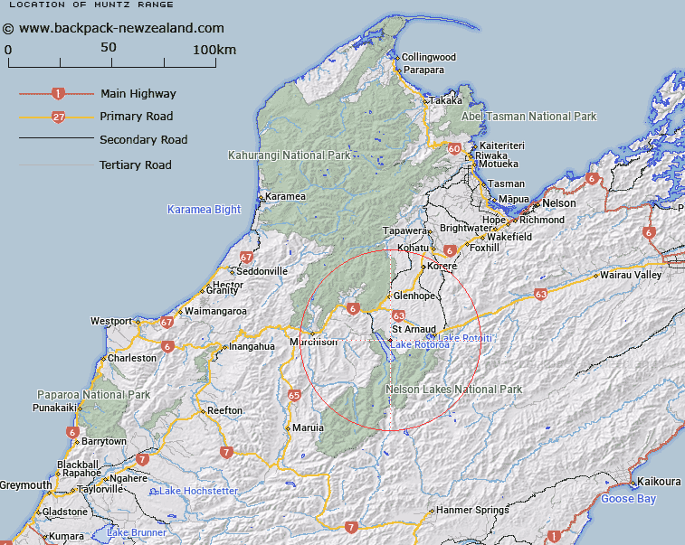
Map showing location of Muntz Range
LINZ description: The mountain divide between the Gowan River, Lake Rotoroa, and the Howard Valley, running generally southward from 898m peak at Topo50 BR24 676817 to 1040+m peak at Topo50 BS24 739658. Blocks X and XIV Hope, Blocks V, X and XIV Howard, Blocks II, III and VII Rotoroa, and Blocks II and VII Arnaud Survey Districts.
Latitude: -41.828137
Longitude: 172.656209
Northing: 5369248.1
Easting: 1571451.6
Land District: Nelson
Feat Type: Range
Latitude: -41.828137
Longitude: 172.656209
Northing: 5369248.1
Easting: 1571451.6
Land District: Nelson
Feat Type: Range

Scroll down to see a more detailed road map and below that a topographical map showing the location of Muntz Range. The road map has been supplied by openstreetmap and the topographical map of Muntz Range has been supplied by Land Information New Zealand (LINZ).
Yes you can use the top static map for you school/university project or personal website with a link back. Contact me for any commercial use.
[ A ] [ B ] [ C ] [ D ] [ E ] [ F ] [ G ] [ H ] [ I ] [ J ] [ K ] [ L ] [ M ] [ N ] [ O ] [ P ] [ Q ] [ R ] [ S ] [ T ] [ U ] [ V ] [ W ] [ X ] [ Y ] [ Z ]