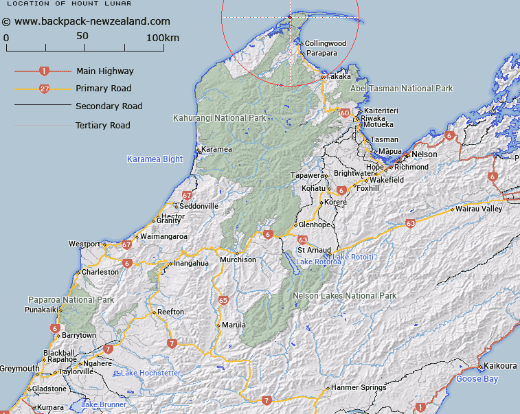
Map showing location of Mount Lunar


LINZ description: A hill feature located 3 kilometres north of Whanganui Inlet
Latitude: -40.531585
Longitude: 172.619349
Northing: 5513169.8
Easting: 1567761.1
Land District: Nelson
Feat Type: Hill


Scroll down to see a more detailed road map and below that a topographical map showing the location of Mount Lunar. The road map has been supplied by openstreetmap and the topographical map of Mount Lunar has been supplied by Land Information New Zealand (LINZ).

Yes you can use the top static map for you school/university project or personal website with a link back. Contact me for any commercial use.

Mount Lunar Map New Zealand


New Zealand places in our database
[ A ] [ B ] [ C ] [ D ] [ E ] [ F ] [ G ] [ H ] [ I ] [ J ] [ K ] [ L ] [ M ] [ N ] [ O ] [ P ] [ Q ] [ R ] [ S ] [ T ] [ U ] [ V ] [ W ] [ X ] [ Y ] [ Z ]


Closest 20 Hills to Mount Lunar

Mount Beale ( 6.16km )   Mount Waters ( 11.2km )   Mount Burnett ( 12.05km )   Knuckle Hill ( 12.49km )   Mount Haidinger ( 18.29km )   Mount Rinopai ( 24.79km )   Red Hill ( 25.11km )   Mount Higgins ( 25.51km )   Macpherson Knob ( 25.9km )   Richmond Hill ( 26.72km )   Devils Hill ( 27.5km )   Fosters Lookout ( 28.01km )   Mount Treblow ( 30.65km )   Lookout Knob ( 31.89km )   Bushy Cone ( 32.26km )   Mount Stevens ( 32.43km )   Peter Knob ( 33.55km )   Parapara Peak ( 34.17km )   Black Cow ( 34.85km )   Centre Peak ( 36.4km )   Brown Knob ( 36.53km )   Red Peak ( 36.95km )   The Minaret ( 37.89km )   The Pulpit ( 38.16km )   Mount Hardy ( 38.38km )   Bare Hill ( 38.76km )   Brown Cow ( 39.04km )   Taup? Hill ( 40.63km )   Lead Hills ( 40.63km )   Percy Peak ( 40.81km )   Conical Hill ( 41.11km )   Mount Christmas ( 41.47km )   Clark Peak ( 41.47km )   Caesar Knob ( 41.68km )   Slate River Peak ( 41.75km )   Paradise Peak ( 42.13km )   Calphurnia Peak ( 42.18km )   Mount Olympus ( 42.24km )   Gladiator Peak ( 43.09km )   Gibbs Hill ( 43.27km )