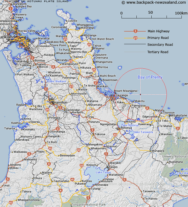
Map showing location of Motunau (Plate Island)


LINZ description: Small island east of Motiti Island. Correction to name currently shown as Plate Island on maps. Feature shown on: NZMS260 V14
Latitude: -37.662459
Longitude: 176.559804
Northing: 5825670
Easting: 1914020
Land District: South Auckland
Feat Type: Island


Scroll down to see a more detailed road map and below that a topographical map showing the location of Motunau (Plate Island). The road map has been supplied by openstreetmap and the topographical map of Motunau (Plate Island) has been supplied by Land Information New Zealand (LINZ).

Yes you can use the top static map for you school/university project or personal website with a link back. Contact me for any commercial use.

Motunau (Plate Island) Map New Zealand


New Zealand places in our database
[ A ] [ B ] [ C ] [ D ] [ E ] [ F ] [ G ] [ H ] [ I ] [ J ] [ K ] [ L ] [ M ] [ N ] [ O ] [ P ] [ Q ] [ R ] [ S ] [ T ] [ U ] [ V ] [ W ] [ X ] [ Y ] [ Z ]


Closest 20 Islands to Motunau (Plate Island)

Motuhaku Island (Schooner Rocks) ( 6.72km )   Motuputa Island ( 10.96km )   Matarehua Island ( 11.12km )   Motukahakaha Island ( 11.37km )   Motupatiki Island ( 11.87km )   Turitea Island ( 11.9km )   Motiti Island ( 12.65km )   Taumaihi Island ( 13.52km )   Motuotau Island ( 32.39km )   Tokata Island ( 32.43km )   Moturiki Island ( 33.18km )   Rurima Island ( 33.24km )   Moutoki Island ( 34.13km )   Motuopuhi Island (Rat Island) ( 34.82km )   Motuopae Island (Peach Island) ( 35.77km )   Rangiwaea Island ( 40.26km )   Motutangaroa Isle ( 40.91km )   Motungaio Island ( 41.6km )   Karewa Island ( 41.73km )   Moutohora Island ( 42.26km )   Motuhora ( 42.26km )   Pateko Island ( 42.9km )   Motuhoa Island ( 43.29km )   Matakana Island ( 43.42km )   Tahunamanu Island ( 43.91km )   Motumauri Island ( 44.14km )   Motuohiwa Island ( 44.49km )   Motuoneone Island ( 49.36km )   Mayor Island (Tuhua) ( 50.3km )   Tawakewake Island (The Queen) ( 50.74km )   Te Hopai Island ( 50.82km )   Tokopapa Island ( 51.12km )   Mokoia Island ( 52.23km )   Egg Island ( 53.01km )   Tutaetaka Island ( 54.94km )   Motuwhetero Island ( 55.78km )   Club Rock ( 56.85km )   Whakaari Island ( 57.2km )   Whakaari/White Island ( 57.2km )   Otumutu Island ( 57.99km )