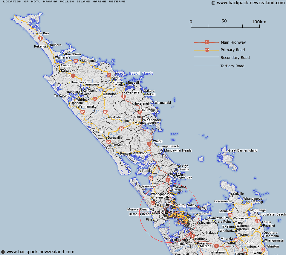
Map showing location of Motu Manawa-Pollen Island Marine Reserve


LINZ description: The Motu Manawa - Pollen Island Marine Reserve protects approximately 500 hectares of the inner reaches of Auckland's Waitemata Harbour. It includes the intertidal mudflats, tidal channels, mangrove swamp, saltmarsh, and shellbanks surrounding Pollen and Traherne Islands. Motu Manawa - Pollen Island Marine Reserve is located in the inner reaches of Auckland's Waitemata Harbour.
Latitude: -36.861944
Longitude: 174.674167
Northing: 5919134.2
Easting: 1749235.7
Land District: North Auckland
Feat Type: Marine Reserve


Scroll down to see a more detailed road map and below that a topographical map showing the location of Motu Manawa-Pollen Island Marine Reserve. The road map has been supplied by openstreetmap and the topographical map of Motu Manawa-Pollen Island Marine Reserve has been supplied by Land Information New Zealand (LINZ).

Yes you can use the top static map for you school/university project or personal website with a link back. Contact me for any commercial use.

Motu Manawa-Pollen Island Marine Reserve Map New Zealand


New Zealand places in our database
[ A ] [ B ] [ C ] [ D ] [ E ] [ F ] [ G ] [ H ] [ I ] [ J ] [ K ] [ L ] [ M ] [ N ] [ O ] [ P ] [ Q ] [ R ] [ S ] [ T ] [ U ] [ V ] [ W ] [ X ] [ Y ] [ Z ]


Closest 20 Marine Reserves to Motu Manawa-Pollen Island Marine Reserve

Long Bay-Okura Marine Reserve ( 22.17km )   Te Matuku Marine Reserve ( 41.66km )   T?wharanui Marine Reserve ( 57.59km )   Cape Rodney-Okakari Point Marine Reserve ( 67.24km )   Whanganui A Hei (Cathedral Cove) Marine Reserve ( 99.46km )   Whangarei Harbour Marine Reserve ( 124.77km )   Tuhua (Mayor Island) Marine Reserve ( 147.63km )   Poor Knights Islands Marine Reserve ( 152.18km )   Parininihi Marine Reserve ( 222.96km )   Te Paepae o Aotea (Volkner Rocks) Marine Reserve ( 228.3km )   Tapuae Marine Reserve ( 253.17km )   Te Tapuwae o Rongokako Marine Reserve ( 367.12km )   Te Angiangi Marine Reserve ( 412.56km )   Kapiti Marine Reserve ( 444.8km )   Westhaven (Te Tai Tapu) Marine Reserve ( 456.98km )   Tonga Island Marine Reserve ( 467.91km )   Long Island - Kokomohua Marine Reserve ( 474km )   Horoirangi Marine Reserve ( 491.17km )   Taputeranga Marine Reserve ( 499.83km )   Kahurangi Marine Reserve ( 510.68km )   Hikurangi Marine Reserve ( 630.42km )   Punakaiki Marine Reserve ( 653.02km )   Pohatu Marine Reserve ( 792.51km )   Akaroa Marine Reserve ( 793.79km )   Waiau Glacier Coast Marine Reserve ( 811.3km )   Tauparik?k? Marine Reserve ( 898.13km )   Hautai Marine Reserve ( 987.3km )   Piopiotahi (Milford Sound) Marine Reserve ( 1034.96km )   Te Hapua (Sutherland Sound) Marine Reserve ( 1059.38km )   Hawea (Clio Rocks) Marine Reserve ( 1068.64km )   Kahukura (Gold Arm) Marine Reserve ( 1114.33km )   Kutu Parera (Gaer Arm) Marine Reserve ( 1129.27km )   Te Awaatu Channel (The Gut) Marine Reserve ( 1138.5km )   Taipari Roa (Elizabeth Island) Marine Reserve ( 1142.08km )   Moana Uta (West Jacket Arm) Marine Reserve ( 1174.64km )   Taumoana (Five Finger Peninsula) Marine Reserve ( 1193.29km )   Te Tapuwae o Hua (Long Sound) Marine Reserve ( 1208.69km )   Ulva Island - Te Wharawhara Marine Reserve ( 1244.39km )