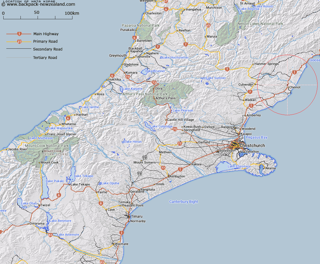
Map showing location of Mata Kopae


LINZ description: Lagoon in St Annes Recreation Reserves, north of Cheviot.
Latitude: -42.780723
Longitude: 173.268956
Northing: 5263500
Easting: 1622000
Land District: Canterbury
Feat Type: Lake


Scroll down to see a more detailed road map and below that a topographical map showing the location of Mata Kopae. The road map has been supplied by openstreetmap and the topographical map of Mata Kopae has been supplied by Land Information New Zealand (LINZ).

Yes you can use the top static map for you school/university project or personal website with a link back. Contact me for any commercial use.

Mata Kopae Map New Zealand


New Zealand places in our database
[ A ] [ B ] [ C ] [ D ] [ E ] [ F ] [ G ] [ H ] [ I ] [ J ] [ K ] [ L ] [ M ] [ N ] [ O ] [ P ] [ Q ] [ R ] [ S ] [ T ] [ U ] [ V ] [ W ] [ X ] [ Y ] [ Z ]


Closest 20 Lakes to Mata Kopae

Lake Stella ( 36.7km )   Lake Rotorua ( 48.86km )   Lake Rotoiti ( 50.06km )   Amberley Beach Lagoon ( 58.52km )   Blue Lagoon ( 59.46km )   Mimimoto Lagoon ( 59.89km )   Leithfield Beach Lagoon ( 63.06km )   Horseshoe Lake ( 64.39km )   Ashworths Ponds ( 66.35km )   Lake McRae ( 66.53km )   Paradise Lake ( 69.66km )   Lake Janet ( 70.77km )   Muddy Lakes ( 72.08km )   Little Lake ( 73.25km )   Lake Guyon ( 74.76km )   Island Lake ( 74.91km )   T?taepatu ( 76.06km )   Tutai Paku Lagoon ( 76.06km )   Bowscale Tarn ( 77.03km )   Lake Sedgemere ( 77.39km )   Lake Tennyson ( 78.27km )   Fish Lake ( 78.43km )   Gabriel Tarn ( 79.25km )   Princess Bath ( 81.67km )   Lake Paget ( 81.96km )   Raupo Pond ( 82.32km )   Lake Raupo ( 82.32km )   Brooklands Lagoon ( 83.42km )   Lake Mary ( 83.46km )   Lake Sheppard ( 83.64km )   Lake Taylor ( 84.73km )   Lake Marion ( 85.3km )   Morris Tarn ( 85.38km )   Lake Sumner ( 86.85km )   Loch Katrine ( 87.84km )   Lake Thompson ( 89.36km )   Mueller Tarn ( 89.7km )   Lake Mason ( 90.05km )   Lake Man ( 90.28km )   Lake Constance ( 92.87km )