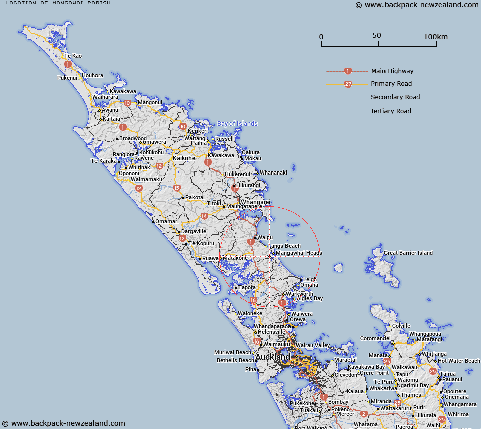
Map showing location of Mangawai Parish


LINZ description: Land registration district name surrounding Mangawhai Harbour and within Mangawhai Survey District. NZTopo50-AY31 402013.
Latitude: -36.122437
Longitude: 174.558217
Northing: 6001347.1
Easting: 1740226.3
Land District: North Auckland
Feat Type: Appellation


Scroll down to see a more detailed road map and below that a topographical map showing the location of Mangawai Parish. The road map has been supplied by openstreetmap and the topographical map of Mangawai Parish has been supplied by Land Information New Zealand (LINZ).

Yes you can use the top static map for you school/university project or personal website with a link back. Contact me for any commercial use.

Mangawai Parish Map New Zealand


New Zealand places in our database
[ A ] [ B ] [ C ] [ D ] [ E ] [ F ] [ G ] [ H ] [ I ] [ J ] [ K ] [ L ] [ M ] [ N ] [ O ] [ P ] [ Q ] [ R ] [ S ] [ T ] [ U ] [ V ] [ W ] [ X ] [ Y ] [ Z ]


Closest 20 Appellations to Mangawai Parish

Waitakere Block ( 84.94km )   Waitakerei Block ( 84.94km )   Mawitipana Maori Block ( 85.2km )   Mawhitipana Maori Block ( 85.2km )   Waikare Block ( 92.32km )   Te Uwhi Block ( 99.61km )   Kirita Maori Block ( 114.06km )   Whatuwhiwhi Block ( 173.04km )   Otamaurunganu Block ( 175.07km )   Otamaurunganui Block ( 175.07km )   Hohoura East ( 201.76km )   Houhora East Survey District ( 201.76km )   Houhora West Survey District ( 211.27km )   Hohoura West ( 211.27km )   Waiari Settlement ( 246.48km )   Waire Settlement ( 246.48km )   Mangapehi ( 273.34km )   Awaateatua Survey District ( 276.53km )   Waiotahi Parish ( 317.67km )   Waiotahe Parish ( 317.67km )   Wheao Survey District ( 325.93km )   Weao ( 325.93km )   Waioeka Parish ( 325.95km )   Ngatiira ( 332.4km )   Ngatira ( 332.4km )   Waiawa East ( 343.82km )   Waiaua East Survey District ( 343.82km )   Matengareka Block ( 353.86km )   Matangareka Block ( 353.86km )   Whakapaupakihi ( 355.07km )   Whakapaupakahi ( 355.07km )   Tuatawhata ( 355.17km )   Tuawatawata ( 355.17km )   Tuwatawata ( 355.17km )   Maungaparahi Block ( 362.03km )   Mangaparahi Block ( 362.03km )   Waiorongomai Block ( 367.29km )   Maikukutea ( 373.45km )   Meakokutea ( 373.45km )   Oriwha ( 375.41km )