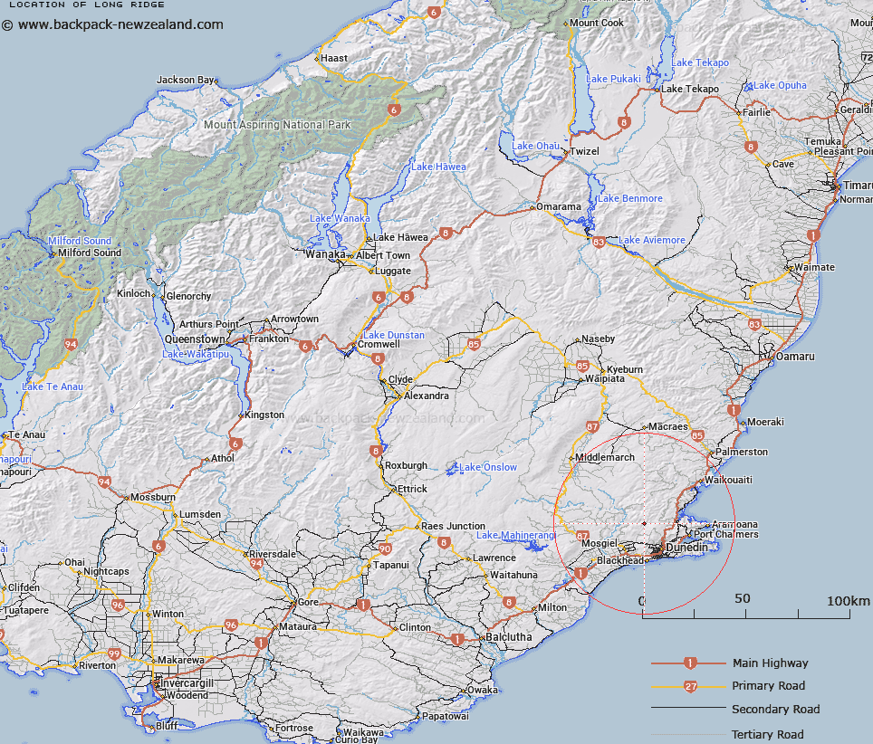
Map showing location of Long Ridge


LINZ description: Ridge running southwards from Pulpit Rock, north of Dunedin
Latitude: -45.769984
Longitude: 170.431573
Northing: 4928300
Easting: 1400300
Land District: Otago
Feat Type: Ridge


Scroll down to see a more detailed road map and below that a topographical map showing the location of Long Ridge. The road map has been supplied by openstreetmap and the topographical map of Long Ridge has been supplied by Land Information New Zealand (LINZ).

Yes you can use the top static map for you school/university project or personal website with a link back. Contact me for any commercial use.

Long Ridge Map New Zealand


New Zealand places in our database
[ A ] [ B ] [ C ] [ D ] [ E ] [ F ] [ G ] [ H ] [ I ] [ J ] [ K ] [ L ] [ M ] [ N ] [ O ] [ P ] [ Q ] [ R ] [ S ] [ T ] [ U ] [ V ] [ W ] [ X ] [ Y ] [ Z ]


Closest 20 Ridges to Long Ridge

Hopkinsons Spur ( 3.7km )   Horse Shoe Spur ( 6.98km )   The Gap ( 8.3km )   Ship Ridge ( 18.02km )   Saunders Ridges ( 28.15km )   Billys Ridge ( 37.24km )   Taieri Ridge ( 41.2km )   Rocky Ridge ( 53.2km )   One Tree Ridge ( 56.03km )   Green Spur ( 60.79km )   Otepopo Spur ( 61.98km )   Cayenne Spur ( 64.77km )   Backbone Ridge ( 65.67km )   Rough Ridge ( 69.04km )   Rocky Ridge ( 70.74km )   Grassy Ridge ( 71.83km )   Half Moon Spur ( 73.12km )   Kakanui Spur ( 75.42km )   Maerewhenua Spur ( 83.58km )   Little Rough Ridge ( 86.93km )   North Rough Ridge ( 87.15km )   Tourist Spur ( 93.59km )   The Stony Ridge ( 96.16km )   Three Stones ( 97.87km )   Flat Top Hill ( 98.61km )   Long Spur ( 99.22km )   Daw Spur ( 101.24km )   Long Spur ( 101.85km )   Walking Spur ( 103.77km )   Sandy Spur ( 105.32km )   Long Spur ( 107.35km )   Archies Spur ( 107.4km )   Short Spur ( 108.63km )   The Falkans Faces ( 109.87km )   Yard Spur ( 110.24km )   Long Spur ( 110.47km )   Isolated Spur ( 111.14km )   Lilico Spur ( 111.26km )   Barneys Spur ( 111.98km )   Hydes Spur ( 114.09km )