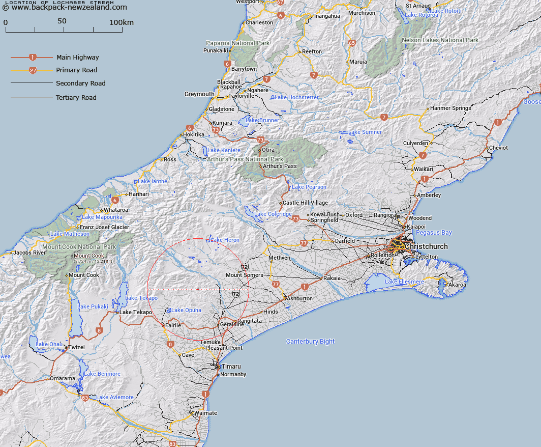
Map showing location of Lochaber Stream


LINZ description: Left bank tributary of Orari River flowing southward joining the Orari River 2km downstream of Lochaber Homestead. Block XIV Mount Peel Survey District.
Latitude: -43.836396
Longitude: 171.093332
Northing: 5144531.2
Easting: 1446714
Land District: Canterbury
Feat Type: Stream


Scroll down to see a more detailed road map and below that a topographical map showing the location of Lochaber Stream. The road map has been supplied by openstreetmap and the topographical map of Lochaber Stream has been supplied by Land Information New Zealand (LINZ).

Yes you can use the top static map for you school/university project or personal website with a link back. Contact me for any commercial use.

Lochaber Stream Map New Zealand


New Zealand places in our database
[ A ] [ B ] [ C ] [ D ] [ E ] [ F ] [ G ] [ H ] [ I ] [ J ] [ K ] [ L ] [ M ] [ N ] [ O ] [ P ] [ Q ] [ R ] [ S ] [ T ] [ U ] [ V ] [ W ] [ X ] [ Y ] [ Z ]


Closest 20 Streams to Lochaber Stream

Mount Peel Creek ( 1.74km )   Moonlight Stream ( 3.93km )   Saddle Hut Stream ( 4km )   Bernard Stream ( 4.36km )   Rocky Stream ( 5.14km )   Basin Stream ( 5.69km )   Moa Stream ( 6.83km )   Pickaxe Stream ( 7.38km )   Dry Creek ( 8.42km )   Coopers Stream ( 8.57km )   Chapmans Creek ( 8.87km )   Pinckney Stream ( 9.21km )   Howards Stream ( 9.29km )   Quartz Creek ( 9.39km )   Parson Stream ( 9.52km )   Totara Stream ( 9.66km )   Soup Stream ( 9.67km )   Lynn Stream ( 9.96km )   Middle Stream ( 10.09km )   Boundary Stream ( 10.29km )   Little Peel Stream ( 10.38km )   McNaughtons Stream ( 11.1km )   Andrews Stream ( 11.12km )   Coal Creek ( 11.17km )   Middlestream ( 11.61km )   Shag Stream ( 11.87km )   Mowbray River ( 12km )   Rata Falls ( 12.15km )   Emily Falls ( 12.31km )   Hewson River ( 12.33km )   Rata Stream ( 12.47km )   Mathias Stream ( 12.63km )   Black Birch Stream ( 12.65km )   Matagouri Stream ( 12.92km )   Powerhouse Stream ( 13.02km )   Taffy Creek ( 13.48km )   Rangitata River ( 13.55km )   Nabob Stream ( 13.71km )   Eyre Stream ( 13.8km )   Phantom River ( 13.85km )