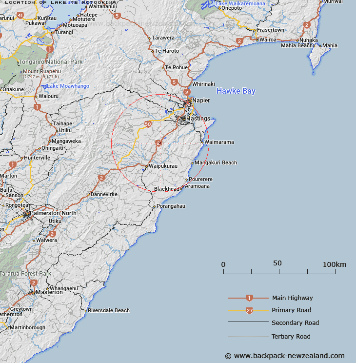
Map showing location of Lake Te Rotookiwa


LINZ description: Located halfway between Hastings and Waipukurau, near Raukawa Range.
Latitude: -39.819167
Longitude: 176.66026
Northing: 5585900
Easting: 1913300
Land District: Hawke's Bay
Feat Type: Lake


Scroll down to see a more detailed road map and below that a topographical map showing the location of Lake Te Rotookiwa. The road map has been supplied by openstreetmap and the topographical map of Lake Te Rotookiwa has been supplied by Land Information New Zealand (LINZ).

Yes you can use the top static map for you school/university project or personal website with a link back. Contact me for any commercial use.

Lake Te Rotookiwa Map New Zealand


New Zealand places in our database
[ A ] [ B ] [ C ] [ D ] [ E ] [ F ] [ G ] [ H ] [ I ] [ J ] [ K ] [ L ] [ M ] [ N ] [ O ] [ P ] [ Q ] [ R ] [ S ] [ T ] [ U ] [ V ] [ W ] [ X ] [ Y ] [ Z ]


Closest 20 Lakes to Lake Te Rotookiwa

Lake Poukawa ( 5.41km )   Horseshoe Lake ( 14.13km )   Hatuma Lake ( 25.18km )   Lake Hatuma ( 25.25km )   Lake Whatuma ( 25.25km )   Runanga Lake ( 27km )   Potaka Lake ( 27.94km )   Oingo Lake ( 29.63km )   Te Roto Kare ( 30.88km )   Long Range Lake ( 36.45km )   Purimu Lake ( 38.59km )   Pandora Pond ( 41.86km )   Westshore Lagoon ( 42.18km )   Northern Pond ( 42.73km )   Colenso Lake ( 47.73km )   Makirikiri Tarns ( 48.62km )   Lake Whalehole ( 48.91km )   The Lakes ( 56.93km )   Lake Pohue ( 63.35km )   Lake Te P?hue ( 63.35km )   Mahangaiti Lake ( 66.08km )   Lake Orakai ( 67.72km )   Lake Waikopiro ( 68.02km )   Lake Poroa ( 68.74km )   Lake T?tira ( 69.32km )   Lake Tutira ( 69.32km )   Rotoataha Lake ( 71.36km )   Lake Horotea ( 73.08km )   Blue Lake ( 74.28km )   Lake Opouahi ( 76.27km )   Lake Moawhango ( 91.36km )   Lake Tamaharau ( 91.78km )   Taumaharau Lake ( 91.85km )   Lake Maungaratanui ( 97.71km )   Lake Pouarua ( 97.74km )   Lake Waiwahi ( 98.09km )   Lake Rotorua ( 98.1km )   Lake Meremere ( 98.24km )   Lake Pounamu ( 98.99km )   Lake Maungarataiti ( 99.03km )