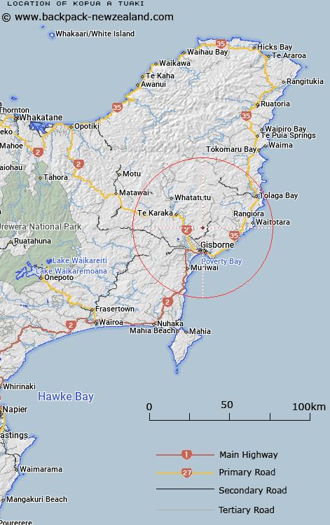
Map showing location of Kopua a Tuaki


LINZ description: Feature shown on: NZMS260 Y17 Edition 1 1984
Latitude: -38.53876
Longitude: 178.008252
Northing: 5722500
Easting: 2036600
Land District: Gisborne
Feat Type: Hill


Scroll down to see a more detailed road map and below that a topographical map showing the location of Kopua a Tuaki. The road map has been supplied by openstreetmap and the topographical map of Kopua a Tuaki has been supplied by Land Information New Zealand (LINZ).

Yes you can use the top static map for you school/university project or personal website with a link back. Contact me for any commercial use.
Kopua a Tuaki Map New Zealand


New Zealand places in our database
[ A ] [ B ] [ C ] [ D ] [ E ] [ F ] [ G ] [ H ] [ I ] [ J ] [ K ] [ L ] [ M ] [ N ] [ O ] [ P ] [ Q ] [ R ] [ S ] [ T ] [ U ] [ V ] [ W ] [ X ] [ Y ] [ Z ]


Closest 20 Hills to Kopua a Tuaki

Motuapouahi ( 1.73km )   Tiritiri ( 1.85km )   Omarutipi ( 2.2km )   Taraokamau ( 3.16km )   Te Patukoura ( 3.37km )   Ngaihihiopoanga ( 3.85km )   Kohuitara ( 4.52km )   Te Matatu ( 4.7km )   Rakurakutara ( 5.48km )   Pukematai ( 5.87km )   Te Kotingaomokaituatini ( 6.47km )   Waipura ( 6.62km )   Kaiwinika ( 6.71km )   Whaitiripapa ( 6.99km )   Makiri ( 7.95km )   Pukeakura ( 8.44km )   Pukenohi ( 8.51km )   Kainaonao ( 8.85km )   Pukenene ( 8.94km )   Motukeo ( 9.32km )   Ngauotekaka ( 9.96km )   Tumokonui ( 10.01km )   Taumatapatiti ( 10.43km )   Town Hill ( 10.95km )   Tatai ( 11.73km )   Ahioteatua ( 12.32km )   Pateika ( 13.34km )   Ahititi ( 13.49km )   Te Kapua ( 13.95km )   Titirangi ( 15.56km )   Pukerua ( 15.57km )   Tikihorohoro ( 15.64km )   Tatapouri ( 15.86km )   Rangiora ( 15.89km )   Takipua ( 15.92km )   Ruamaere ( 16.52km )   Te Rewa ( 16.63km )   Kererurukaipo ( 17.1km )   Rangatira ( 17.65km )   Kiorekaitarahore ( 17.72km )