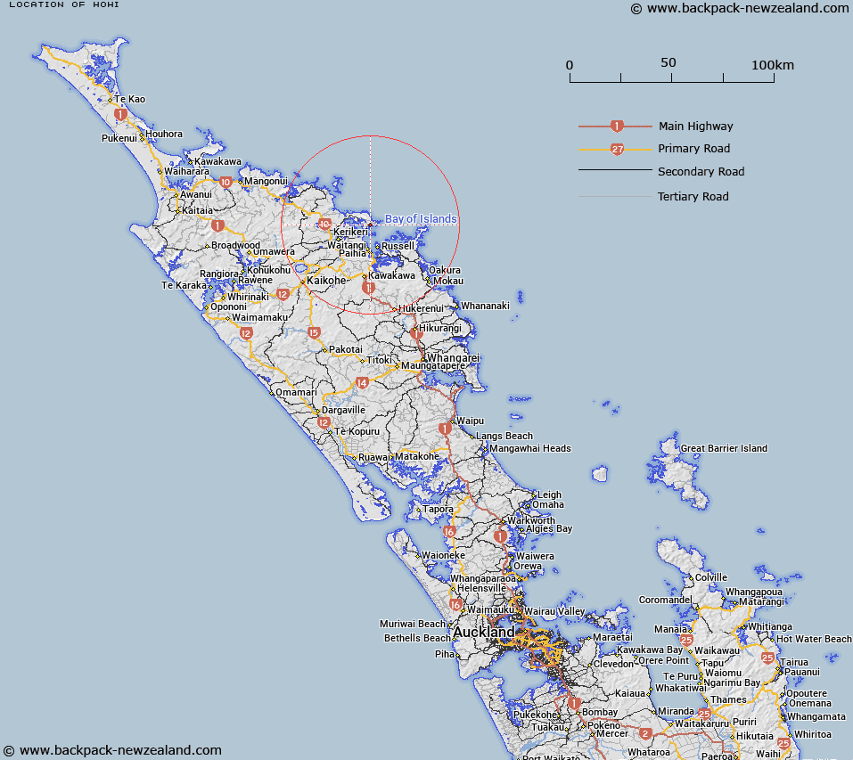
Map showing location of Hohi


LINZ description: The site is contained within the Marsden Cross Historic Reserve Section 17, Block IX Kerikeri Survey District Lot 1 DP78755
Latitude: -35.168321
Longitude: 174.095344
Northing: 6107741.3
Easting: 1699748.9
Land District: North Auckland
Feat Type: Site


Scroll down to see a more detailed road map and below that a topographical map showing the location of Hohi. The road map has been supplied by openstreetmap and the topographical map of Hohi has been supplied by Land Information New Zealand (LINZ).

Yes you can use the top static map for you school/university project or personal website with a link back. Contact me for any commercial use.

Hohi Map New Zealand


New Zealand places in our database
[ A ] [ B ] [ C ] [ D ] [ E ] [ F ] [ G ] [ H ] [ I ] [ J ] [ K ] [ L ] [ M ] [ N ] [ O ] [ P ] [ Q ] [ R ] [ S ] [ T ] [ U ] [ V ] [ W ] [ X ] [ Y ] [ Z ]


Closest 20 Sites to Hohi

Rangihoua Pa ( 0.37km )   Pukewhau Pa ( 5.36km )   Tikorangi Pa ( 5.95km )   Whitiora Pa ( 8.59km )   Tapeka Pa ( 8.62km )   Hikurangi Pa ( 10.17km )   Haikai Pa ( 10.33km )   Paoeone Pa ( 10.44km )   Captain Cook's Anchorage ( 10.65km )   Paeroa Pa ( 11.43km )   Waitangi Marae ( 11.95km )   Kahuwhera Pa ( 13km )   Paroa Pa ( 13.68km )   Taurikura Pa ( 13.76km )   Te Hue Pa ( 14km )   Kokinga Pa ( 15.66km )   Rangihamama Pa ( 16.2km )   Orongo Pa ( 16.3km )   Pukewhau Pa ( 16.48km )   Mokunui Arangi Pa ( 16.52km )   Puketona Pa ( 16.65km )   Parahi Pa ( 16.72km )   Te Rawhiti Marae ( 16.82km )   Haimama Pa ( 16.86km )   Rangihoua Pa ( 16.92km )   Mangaroa Pa ( 18.82km )   Pahi Pa ( 20.87km )   Paringaringa Pa ( 21.05km )   Matawhero Pa ( 21.2km )   Hukahuka Pa ( 21.34km )   Waikare Marae ( 22.28km )   Puketohunga Pa ( 22.54km )   Karetu Pa ( 22.95km )   Karetu Marae ( 23.4km )   Whakataha Pa ( 24.24km )   Te Rangaita Pa ( 24.39km )   Ngaungau Pa ( 24.58km )   Opounui Pa ( 24.87km )   Opepe Pa ( 25.07km )   Hauwhenua Pa ( 25.3km )