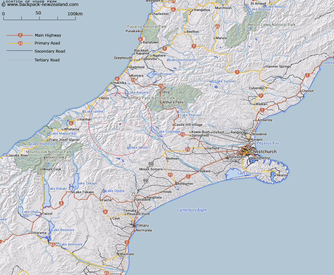
Map showing location of Hinge Peak


LINZ description: Between Cattle Creek and West Mathias
Latitude: -43.19872
Longitude: 171.06514
Northing: 5215300
Easting: 1442800
Land District: Canterbury
Feat Type: Hill


Scroll down to see a more detailed road map and below that a topographical map showing the location of Hinge Peak. The road map has been supplied by openstreetmap and the topographical map of Hinge Peak has been supplied by Land Information New Zealand (LINZ).

Yes you can use the top static map for you school/university project or personal website with a link back. Contact me for any commercial use.

Hinge Peak Map New Zealand


New Zealand places in our database
[ A ] [ B ] [ C ] [ D ] [ E ] [ F ] [ G ] [ H ] [ I ] [ J ] [ K ] [ L ] [ M ] [ N ] [ O ] [ P ] [ Q ] [ R ] [ S ] [ T ] [ U ] [ V ] [ W ] [ X ] [ Y ] [ Z ]


Closest 20 Hills to Hinge Peak

Observation Cone ( 1.93km )   Bonds Peak ( 4.13km )   Mount Warner ( 4.17km )   Laws Peak ( 4.29km )   Mount Neave ( 4.35km )   Totara Peak ( 6.61km )   Mount McWhirter ( 6.85km )   Jourdain Cone ( 7.67km )   Mount Young ( 8.18km )   Agfa Knob ( 9.14km )   Mount Split Open ( 9.41km )   Urquhart Peak ( 9.53km )   Amazons Breasts ( 9.54km )   Comyns Peak ( 9.55km )   Mount Tarleton ( 9.73km )   Mount Van Redan ( 9.83km )   Johanson Peak ( 9.97km )   Louper Peak ( 10.01km )   Lauper Peak ( 10.01km )   Mount Marion ( 10.18km )   Mount Thorndike ( 10.19km )   Mistake Hill ( 10.59km )   Monarch Hill ( 10.7km )   Mount Carl ( 10.77km )   Button Peak ( 10.79km )   Vincent Peak ( 10.97km )   Manuka Peak ( 11.18km )   Mount Medhurst ( 11.19km )   Mount Frieda ( 11.35km )   Mount Evans ( 11.38km )   Little Hill ( 11.57km )   Erewhon Peak ( 11.82km )   Park Dome ( 11.87km )   Mount Wylde Brown ( 12.03km )   Bastion Peaks ( 12.15km )   Mount Butler ( 12.22km )   The Red Lion ( 12.25km )   Mount Whitcombe ( 12.5km )   Prospect Hill ( 12.51km )   Spires Peak ( 12.74km )